Canton in Cherokee County, Georgia — The American South (South Atlantic)
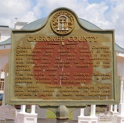
Cherokee County
The Marietta and North Georgia Railroad reached Canton in 1879, providing a considerable stimulus to development.
The locally financed and managed textile mill, which began operations in 1900, has provided a payroll of much local importance.
Erected 1953 by Georgia Historical Commission. (Marker Number 028-2.)
Topics and series. This historical marker is listed in these topic lists: Industry & Commerce • Native Americans • Political Subdivisions • Railroads & Streetcars. In addition, it is included in the Georgia Historical Society series list. A significant historical date for this entry is December 3, 1869.
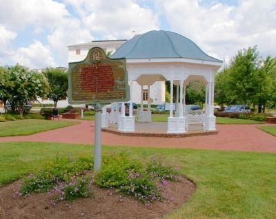
Location. 34° 14.223′ N, 84° 29.451′ W. Marker is in Canton, Georgia, in Cherokee County. Marker is at the intersection of West Main Street (Georgia Route 205) and South Church Street, on the left when traveling east on West Main Street. The marker is installed at a gazebo in a landscaped square in front of the Cherokee County House. Touch for map. Marker is in this post office area: Canton GA 30114, United States of America. Touch for directions.
Other nearby markers. At least 8 other markers are within 11 miles of this marker, measured as the crow flies. Cherokee County Gold (a few steps from this marker); Joseph Emerson Brown (about 700 feet away, measured in a direct line); Crescent Farm Rock Barn (approx. half a mile away); Fort Buffington (approx. 4.4 miles away); Dallas Scott Hudgens, Jr. (approx. 5.1 miles away); "Eternal Patrol" (approx. 5.2 miles away); Battle of Taliwa (approx. 9.6 miles away); Thomas B. Newton House (approx. 10.2 miles away). Touch for a list and map of all markers in Canton.
Regarding Cherokee County. The mill mentioned on the marker closed a number of years ago; after a number of attempts, the building has now been adaptively reused as shops and apartments.
Credits. This page was last revised on June 16, 2016. It was originally submitted on August 21, 2009, by David Seibert of Sandy Springs, Georgia. This page has been viewed 1,388 times since then and 17 times this year. Photos: 1, 2, 3. submitted on August 21, 2009, by David Seibert of Sandy Springs, Georgia. • Craig Swain was the editor who published this page.


