Mt. Vernon in Montgomery County, Georgia — The American South (South Atlantic)
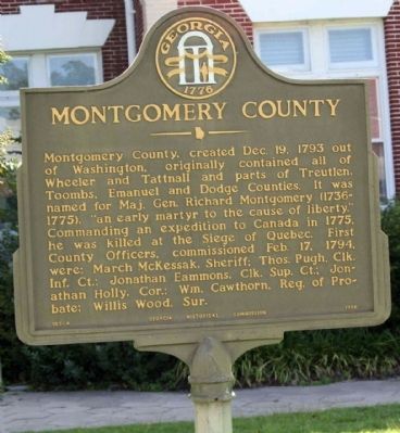
Montgomery County
Erected 1956 by Georgia Historical Commission. (Marker Number 103-4.)
Topics and series. This historical marker is listed in this topic list: Political Subdivisions. In addition, it is included in the Georgia Historical Society series list. A significant historical date for this entry is February 17, 1991.
Location. 32° 10.451′ N, 82° 35.696′ W. Marker is in Mt. Vernon, Georgia, in Montgomery County. Marker is on McEachin Street (U.S. 221) near West Church Street, on the left when traveling south. Located at the Courthouse. Touch for map. Marker is in this post office area: Mount Vernon GA 30445, United States of America. Touch for directions.
Other nearby markers. At least 8 other markers are within 11 miles of this marker, measured as the crow flies. A different marker also named Montgomery County (a few steps from this marker); Montgomery County Courthouse (a few steps from this marker); Montgomery County Veterans Memorial (a few steps from this marker); Montgomery County Confederate Monument (a few steps from this marker); Nancy Hart Highway (approx. 4˝ miles away); Erected by Works Progress Administration (approx. 10.8 miles away); Minenwerfer (approx. 10.8 miles away); Unknown Confederate Graves (approx. 10.9 miles away). Touch for a list and map of all markers in Mt. Vernon.
Credits. This page was last revised on June 16, 2016. It was originally submitted on August 22, 2009, by Mike Stroud of Bluffton, South Carolina. This page has been viewed 931 times since then and 15 times this year. Photos: 1, 2. submitted on August 22, 2009, by Mike Stroud of Bluffton, South Carolina. • Craig Swain was the editor who published this page.

