Joplin in Jasper County, Missouri — The American Midwest (Upper Plains)
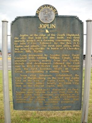
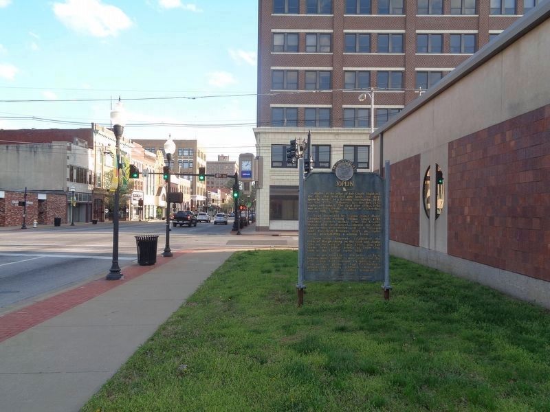
Joplin
Lead, discovered by Neosho miner David Campbell while visiting William Tingle, 1849, attracted settlers mainly from the Ozarks, though real development followed the Civil War. In 1870 E.R. Moffet and J.B. Sergeant sank the first bonanza shaft on Joplin Creek, precipitating a mining boom.
Soon rival interests established the town of Murphysburg on the west and Joplin City on the east of Joplin Creek. The two towns were joined briefly as Union City, then as the City of Joplin, 1873.
Zinc ore (blackjack), discarded at first, became more valuable to mine than lead. By 1890 Joplin held national recognition as a lead and zinc producer. Capt. E.O. Bartlett's process for making sublimed white lead contributed to the expanded prosperity.
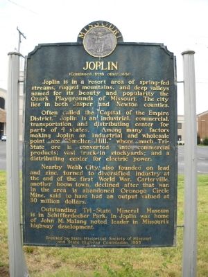
Joplin is in a resort area of spring-fed streams, rugged mountains, and deep valleys named for its beauty and popularity the Ozark Playgrounds of Missouri. The city lies in both Jasper and Newton Counties.
Often called the "Capital of the Empire District," Joplin is an industrial, commercial, transportation, and distributing center for parts of 4 states. Among many factors making Joplin an industrial and wholesale point are "Smelter Hill," where much Tri-state ore is converted into commercial products;vast truck-in stockyards;and a distributing center for electric power.
Nearby Webb City, also founded on lead and zinc, turned to diversified industry at the end of first World War. Carterville, another boom town, declined after that war. In the area is abandoned Oronogo Circle Mine, said to have an output valued at 30 million dollars.
Outstanding Tri-State Mineral Museum in in Schifferdecker Par. In Joplin was home of John M Malang noted leader in Missouri's highway development.
Erected 1953 by State Historical Society of Missouri and State Highway Commission.
Topics and series. This historical marker is listed in these topic lists: Industry & Commerce • Native Americans • Settlements & Settlers. In addition, it is included in the Missouri, The State Historical Society of series list. A significant historical year for this entry is 1838.
Location. 37° 5.271′ N, 94° 30.811′ W. Marker is in Joplin, Missouri, in Jasper County. Marker is at the intersection of South Main Street (Missouri Route 43) and East 4th Street, on the right when traveling south on South Main Street. Marker is located outside the former Joplin Public Library building (see comment). Touch for map. Marker is at or near this postal address: 402 S Main St, Joplin MO 64801, United States of America. Touch for directions.
Other nearby markers. At least 8 other markers are within walking distance of this marker. Quinby Building (within shouting distance of this marker); The Connor Hotel (within shouting distance of this marker); Swartz & Malsbury Building (about 400 feet away, measured in a direct line); Jasper County Courthouse (approx. 0.3 miles away); Joplin World War II Memorial (approx. 0.4 miles away); Joplin Korean War and Vietnam War Memorial (approx. 0.4 miles away); Birds Eye View of Joplin 1877 (approx. 0.4 miles away); Discovery of Lead (approx. 0.4 miles away). Touch for a list and map of all markers in Joplin.
Additional commentary.
1. Marker was moved to outside the former public library building
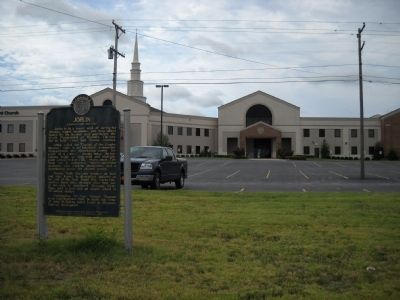
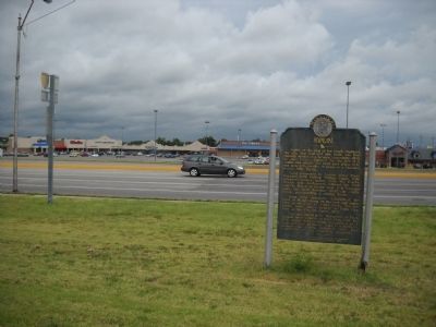
The Joplin marker was originally located at the intersection of 7th Street (Old U.S. 66 and Business Route 44) and Rangeline Road, just outside the Forest Park Joplin church grounds. I am not sure when it moved, or the reasons. My main guess was, possibly, the city leaders may have wanted to move it downtown - to help give the city of Joplin a new life after the 2011 tornado, which destroyed several buildings. Sometime during the 2010s, I assume, the marker was placed outside Joplin Public Library. The library would be relocated to East 20th Street in 2017 and as of April 2021, the old building is vacant.
— Submitted May 22, 2021, by Jason Voigt of Glen Carbon, Illinois.
Credits. This page was last revised on May 22, 2021. It was originally submitted on August 23, 2009, by Thomas Onions of Olathe, Kansas. This page has been viewed 1,687 times since then and 40 times this year. Photos: 1, 2, 3, 4. submitted on August 26, 2009, by Thomas Onions of Olathe, Kansas. 5. submitted on May 22, 2021, by Jason Voigt of Glen Carbon, Illinois. • Kevin W. was the editor who published this page.
