Stafford in Stafford County, Virginia — The American South (Mid-Atlantic)
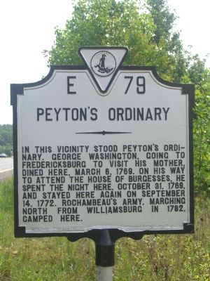
Peyton’s Ordinary
Erected 1947 by Virginia Conservation Commission. (Marker Number E-79.)
Topics and series. This historical marker is listed in these topic lists: Colonial Era • Industry & Commerce • Patriots & Patriotism • War, US Revolutionary. In addition, it is included in the Former U.S. Presidents: #01 George Washington, the George Washington Slept Here, the The Washington-Rochambeau Route, and the Virginia Department of Historic Resources (DHR) series lists. A significant historical month for this entry is March 1878.
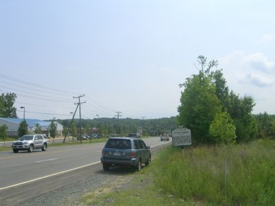
Location. 38° 27.118′ N, 77° 24.264′ W. Marker is in Stafford, Virginia, in Stafford County. Marker is on Jefferson Davis Highway (U.S. Rt 1), on the right when traveling south. Touch for map. Marker is in this post office area: Stafford VA 22554, United States of America. Touch for directions.
Other nearby markers. At least 8 other markers are within 2 miles of this marker, measured as the crow flies. Mary Kittamaquund (approx. 0.2 miles away); Fleurries (approx. 0.8 miles away); Aquia Church (approx. 0.9 miles away); Government Island (approx. 0.9 miles away); a different marker also named Government Island (approx. one mile away); The Robertson Quarry (approx. 1.1 miles away); Austin Run Pyrite Mine (approx. 1.2 miles away); Site Selection / Architectural Features (approx. 1.3 miles away). Touch for a list and map of all markers in Stafford.
Also see . . . French Army’s march North in Virginia, 1782. (Submitted on August 28, 2007, by Kevin W. of Stafford, Virginia.)
Credits. This page was last revised on December 27, 2019. It was originally submitted on August 28, 2007, by Kevin W. of Stafford, Virginia. This page has been viewed 3,774 times since then and 80 times this year. Photos: 1, 2. submitted on August 28, 2007, by Kevin W. of Stafford, Virginia. • J. J. Prats was the editor who published this page.

