Middletown in Frederick County, Maryland — The American Northeast (Mid-Atlantic)
Middletown
Enemies and Friends
— Antietam Campaign 1862 —
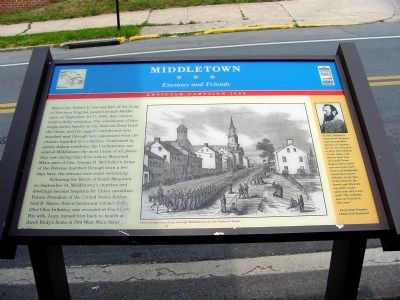
Following the Battle of South Mountain on September 14, Middletown's churches and dwellings became hospitals for Union casualties. Future President of the United States Rutherford B. Hayes, then a lieutenant colonel of the 23rd Ohio Infantry, was wounded at Fox's Gap. His wife, Lucy, nursed him back to health at Jacob Rudy's home at 504 West Main Street.
As Gen. Thomas J. “Stonewall” Jackson rode through Middletown on September 10, two very pretty girls with ribbons of red, white, and blue in their hair and small Union flags in their hands ran out to the curbstone, and laughingly waved their colors defiantly in the face of the General. He bowed and lifted his cap with a quite smile and said to his staff, “We evidently have no friends in this town.” –Henry Kyd Douglas, I Rode with Stonewall
Erected by Maryland Civil War Trails.
Topics and series. This historical marker is listed in this topic list: War, US Civil. In addition, it is included in the Maryland Civil War Trails series list. A significant historical year for this entry is 1862.
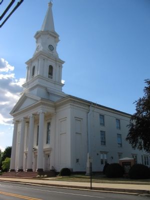
Location. 39° 26.63′ N, 77° 32.879′ W. Marker is in Middletown, Maryland, in Frederick County. Marker is at the intersection of West Main Street (Alternate U.S. 40) and Elm Street, on the left when traveling west on West Main Street. Located in front of the Central Maryland Heritage League Building. Touch for map. Marker is at or near this postal address: 200 West Main Street, Middletown MD 21769, United States of America. Touch for directions.
Other nearby markers. At least 8 other markers are within walking distance of this marker. A different marker also named Middletown (here, next to this marker); a different marker also named Middletown (here, next to this marker); Lamar House (here, next to this marker); Appleman's Tannery (a few steps from this marker); Middletown in the Civil War (within shouting distance of this marker); a different marker also named Middletown (within shouting distance of this marker);
Joshua Beckwith House (within shouting distance of this marker); 301 West Main Street (about 300 feet away, measured in a direct line). Touch for a list and map of all markers in Middletown.
More about this marker. The center of the marker displays a drawing of Union troops marching through Middletown on the National Road. A portrait of Gen. Jackson is on the right in the sidebar.
Photographed By Craig Swain, July 21, 2007
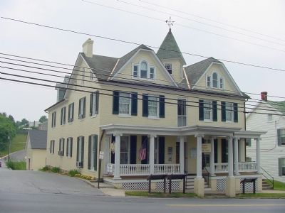
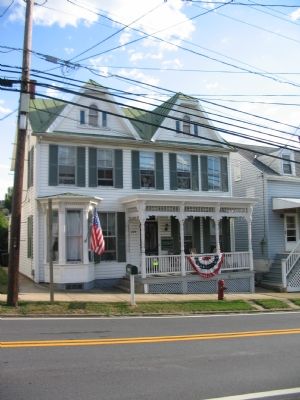
6. Crouse House (204 West Main Street)
When the Confederates first arrived in town on September 10, 1862, Nancy Crouse had a large U.S. flag flying from the second floor balcony. Confederate cavalrymen entered the house to remove the flag, but found Mrs. Crouse had wrapped herself in the flag and proclaimed, "You may shoot me, but never will I willingly give up my country's flag into the hands of traitors." Although she would lose the flag after a fight, it was later returned to her when captured at Antietam.
Credits. This page was last revised on June 16, 2016. It was originally submitted on July 4, 2006, by J. J. Prats of Powell, Ohio. This page has been viewed 3,299 times since then and 25 times this year. Last updated on August 24, 2009, by Sarah Hovde of Rocky Ridge, Maryland. Photos: 1. submitted on July 4, 2006, by J. J. Prats of Powell, Ohio. 2. submitted on June 25, 2006, by J. J. Prats of Powell, Ohio. 3. submitted on August 9, 2015, by Brandon Fletcher of Chattanooga, Tennessee. 4, 5, 6. submitted on July 23, 2007, by Craig Swain of Leesburg, Virginia. • Kevin W. was the editor who published this page.
