Near Pine Mountain in Harris County, Georgia — The American South (South Atlantic)
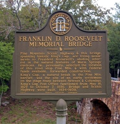
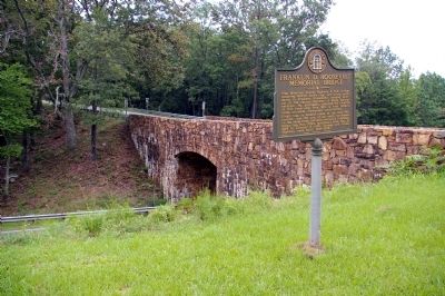
Franklin D. Roosevelt Memorial Bridge
King’s Gap, a natural break in the Pine Mtn. barrier, was the site of an early settlement on the stage route between Newnan & Columbus. King’s Gap Post Office functioned from May 16, 1829 to October 7, 1856. Bridge and Scenic Highway were built, 1934-1938.
Erected 1957 by Georgia Historical Commission. (Marker Number 072-8.)
Topics and series. This historical marker is listed in these topic lists: Bridges & Viaducts • Roads & Vehicles. In addition, it is included in the Former U.S. Presidents: #32 Franklin D. Roosevelt, and the Georgia Historical Society series lists. A significant historical month for this entry is May 1917.
Location. 32° 50.443′ N, 84° 48.559′ W. Marker is near Pine Mountain, Georgia, in Harris County. Marker is at the intersection of Georgia Route 190 and Georgia Route 354, on the right when traveling west on State Route 190. Touch for map. Marker is in this post office area: Pine Mountain GA 31822, United States of America. Touch for directions.
Other nearby markers. At least 8 other markers are within 4 miles of this marker, measured as the crow flies. Callaway Gardens (approx. 2.2 miles away); The J.L. Hand Gazebo (approx. 2.7 miles away); Smokehouse (approx. 2.8 miles away); Pioneer Log Cabin (approx. 2.8 miles away); Pine Mountain Valley Resettlement Project (approx. 2.9 miles away); The Iron Horse (approx. 3.1 miles away); Chipley - Pine Mountain, Georgia (approx. 3.2 miles away); Valley of Hope (approx. 3.3 miles away). Touch for a list and map of all markers in Pine Mountain.
Credits. This page was last revised on January 3, 2020. It was originally submitted on August 29, 2009, by David Seibert of Sandy Springs, Georgia. This page has been viewed 2,049 times since then and 40 times this year. Photos: 1, 2. submitted on August 29, 2009, by David Seibert of Sandy Springs, Georgia. • Craig Swain was the editor who published this page.

