Westwood in Lassen County, California — The American West (Pacific Coastal)
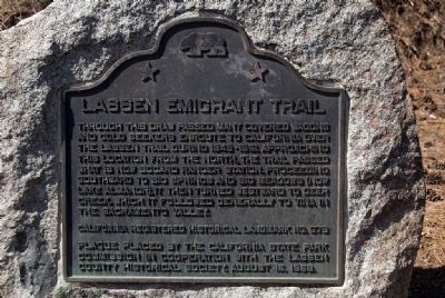
Lassen Emigrant Trail
California Registered Historical Landmark No. 678
Plaque placed by the California State Park Commission in cooperation with the Lassen County Historical Society. August 15, 1959
Erected 1959 by California State Park Commission in cooperation with the Lassen County Historical Society. (Marker Number 678.)
Topics and series. This historical marker is listed in these topic lists: Roads & Vehicles • Settlements & Settlers. In addition, it is included in the California Historical Landmarks, and the Lassen Trail and Burnett Cutoff series lists. A significant historical year for this entry is 1959.
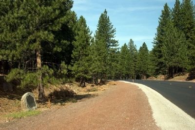
Location. 40° 18.867′ N, 121° 3.35′ W. Marker is in Westwood, California, in Lassen County. Marker is on Highway 36, on the right when traveling east. Touch for map. Marker is in this post office area: Westwood CA 96137, United States of America. Touch for directions.
Other nearby markers. At least 8 other markers are within 3 miles of this marker, measured as the crow flies. Westwood Masonic Lodge (approx. 2.9 miles away); Westwood Club (approx. 2.9 miles away); Boardinghouses (approx. 2.9 miles away); Chuck’s Railroad Room (approx. 3 miles away); Westwood Firehouse (approx. 3 miles away); Westwood (approx. 3 miles away); Lassen Trail - Westwood (approx. 3 miles away); Paul Bunyan (approx. 3 miles away). Touch for a list and map of all markers in Westwood.
Credits. This page was last revised on June 16, 2016. It was originally submitted on August 30, 2009, by Karen Key of Sacramento, California. This page has been viewed 1,317 times since then and 10 times this year. Photos: 1, 2. submitted on August 30, 2009, by Karen Key of Sacramento, California.

