Near Fredericksburg in Stafford County, Virginia — The American South (Mid-Atlantic)
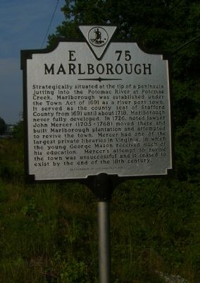
Marlborough
Erected 2001 by Department of Historic Resources. (Marker Number E-75.)
Topics and series. This historical marker is listed in these topic lists: Colonial Era • Political Subdivisions • Settlements & Settlers. In addition, it is included in the Virginia Department of Historic Resources (DHR) series list. A significant historical year for this entry is 1691.
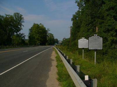
Location. 38° 22.53′ N, 77° 27.087′ W. Marker is near Fredericksburg, Virginia, in Stafford County. Marker is on Jefferson Davis Highway (U.S. 1) 0.4 miles north of Centreport Parkway, on the right when traveling north. Touch for map. Marker is at or near this postal address: 1050 Jefferson Davis Hwy, Fredericksburg VA 22405, United States of America. Touch for directions.
Other nearby markers. At least 8 other markers are within 3 miles of this marker, measured as the crow flies. Kidnapping of Pocahontas (here, next to this marker); "Lest We Forget" (approx. 1.2 miles away); Land for God's Work (approx. 1˝ miles away); Milton Snellings (approx. 1.6 miles away); Hulls Memorial Baptist Church (approx. 1.6 miles away); Original Bell of Hulls Memorial Baptist Church (approx. 1.7 miles away); Veterans Memorial (approx. 1.8 miles away); History at Leeland Station (approx. 2.3 miles away). Touch for a list and map of all markers in Fredericksburg.
More about this marker. This marker replaced a marker with the same number and title erected in the late 1920s or early 1930s south of here (about 4 miles north of Fredericksburg). It read, “At Potomac Neck, four miles east, land was laid off in 1691 for a port and the town of Stafford County, called Marlborough. Houses were built and the county court was held there for some years. The town did not grow, and in 1747, John Mercer bought the county’s rights in it.”
Credits. This page was last revised on February 2, 2023. It was originally submitted on August 30, 2007, by Kevin W. of Stafford, Virginia. This page has been viewed 3,555 times since then and 102 times this year. Photos: 1, 2. submitted on August 30, 2007, by Kevin W. of Stafford, Virginia. • J. J. Prats was the editor who published this page.

