Near Blanchard in Hardin County, Ohio — The American Midwest (Great Lakes)
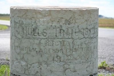
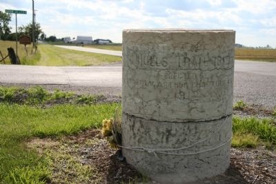
Hull's Trail, 1812
Erected By
Fort McArthur Chapter, D.A.R.
1912
Erected 1912 by Fort McArthur Chapter, Daughters of the American Revolution.
Topics and series. This historical marker is listed in these topic lists: Roads & Vehicles • War of 1812 • Wars, US Indian. In addition, it is included in the Daughters of the American Revolution series list. A significant historical year for this entry is 1812.
Location. 40° 43.913′ N, 83° 39.169′ W. Marker is near Blanchard, Ohio, in Hardin County. Marker is at the intersection of County Route 135 and Ohio Route 701, on the right when traveling north on County Route 135. Touch for map. Marker is at or near this postal address: 12052 Route 701, Dunkirk OH 45836, United States of America. Touch for directions.
Other nearby markers. At least 8 other markers are within 5 miles of this marker, measured as the crow flies. A different marker also named Hull’s Trail (about 400 feet away, measured in a direct line); Dunkirk Veterans Memorial (approx. 3.1 miles away); a different marker also named Hull's Trail, 1812 (approx. 3.4 miles away); To Remember Veterans Of All Wars (approx. 4 miles away); a different marker also named To Remember Veterans Of All Wars (approx. 4.3 miles away); This Tablet Marks Hull’s Trail; 1812 (approx. 4.7 miles away); Fort McArthur Cemetery (approx. 4.8 miles away); Hog-Creek Marsh (approx. 4.9 miles away).
Related markers. Click here for a list of markers that are related to this marker. To better understand the relationship, study each marker in the order shown.
Also see . . . Hull's Road. This is a link to information provided by Ohio History Central, an online encyclopedia of Ohio History. (Submitted on August 13, 2010, by Dale K. Benington of Toledo, Ohio.)
Credits. This page was last revised on May 18, 2022. It was originally submitted on September 16, 2009, by Dale K. Benington of Toledo, Ohio. This page has been viewed 1,406 times since then and 18 times this year. Last updated on May 16, 2022, by Craig Doda of Napoleon, Ohio. Photos: 1, 2. submitted on September 16, 2009, by Dale K. Benington of Toledo, Ohio. • Devry Becker Jones was the editor who published this page.

