Leesburg in Loudoun County, Virginia — The American South (Mid-Atlantic)
A Divided America, A Divided Loudoun County

Photographed By Devry Becker Jones (CC0), March 6, 2021
1. A Divided America, A Divided Loudoun County Marker
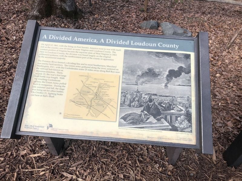
On April 12, 1861, with the firing on Fort Sumter, America went to war with itself. Just as the country was divided, so were Virginia and Loudoun County. The western portion of Virginia became the separate state of West Virginia in 1863. Here in Loudoun County, the division was based largely on the original settlement patterns, with the northwestern part of the county in opposition to the secessionist majority.
The Potomac River formed a dividing line and to most Southerners, Maryland was enemy held territory. The Union army gathered along the river, centered on Washington, D.C., with the Confederates some 25 miles away along Bull Run near the railroad hub known as Manassas Junction. There, on July 21, the war's first large land battle was fought. With the resulting Confederate victory, the Union Army pulled back to reorganize. During the late summer and fall, the stage was being set for other battles. On October 21, fighting broke out here at Ballís Bluff.
Erected by Ballís Bluff Regional Park/Northern Virginia Regional Park Authority.
Topics and series. This historical marker is listed in this topic list: War, US Civil. In addition, it is included in the NOVA Parks series list. A significant historical month for this entry is April 1863.
Location. 39° 7.827′ N, 77° 31.847′ W. Marker is in Leesburg, Virginia, in Loudoun County. Marker can be reached from Ballís Bluff Road, on the left when traveling east. Located next to the parking lot for Ballís Bluff Regional Park. Touch for map. Marker is in this post office area: Leesburg VA 20176, United States of America. Touch for directions.
Other nearby markers. At least 8 other markers are within walking distance of this marker. The Battle of Ball's Bluff in Perspective (here, next to this marker); Aftermath of Ballís Bluff (here, next to this marker); Battle of Balls Bluff (here, next to this marker); Additional Area Civil War Sites (here, next to this marker); The Battle at Ballís Bluff (within shouting distance of this marker); Battle of Ball's Bluff - October 21, 1861 (about 300 feet away, measured in a direct line); a different marker also named The Battle of Ball's Bluff (about 300 feet away); 8th Virginia Volunteer Infantry Regiment (about 500 feet away). Touch for a list and map of all markers in Leesburg.
More about this marker. The marker has a county map depicting the division between areas of Union and Confederate sentiments.
A newspaper drawing shows, ďThe housetops in Charleston during the bombardment of SumterĒ from Harperís Weekly, May 4, 1861.
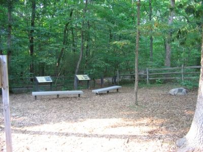
Regarding A Divided America, A Divided Loudoun County. Related Markers Note: This marker is one of a set along the Ball's Bluff Battlefield walking trail. See the Ballís Bluff Virtual Tour by Markers link below for details on each stop.
Related marker. Click here for another marker that is related to this marker. This marker has replaced the linked marker.
Also see . . .
1. Battle of Balls Bluff. A brief overview. (Submitted on August 29, 2007, by Craig Swain of Leesburg, Virginia.)
2. Official Reports. Written by the officers who led units in the battle. (Submitted on August 29, 2007, by Craig Swain of Leesburg, Virginia.)
3. A County Divided. Loudoun County and the Civil War. (Submitted on August 29, 2007, by Craig Swain of Leesburg, Virginia.)
4. Balls Bluff Battlefield Virtual Tour by Marker. Over twenty markers detail the action at Balls Bluff and related sites. Please use the Click to map all markers shown on this page option at the bottom of the page to view a map of the marker locations. The hybrid view offers an excellent overlook of the park. (Submitted on November 11, 2007, by Craig Swain of Leesburg, Virginia.)
Additional commentary.
1. Narrative from the Older Version of the Marker
On April 12, 1861, the storm clouds of war erupted over a divided America with the firing on Fort Sumter in Charleston Harbor, South Carolina. Just as America was divided in 1861, so was Virginia. Virginiaís western half would form a separate pro-Union state in 1863. Loudoun County was also split. Here in Loudoun County the division was based on settlement patterns.
In the weeks following the loss of Fort Sumter, the Union Army formed around Washington, D.C. The Confederate Army gathered at Manassas Junction, Virginia, twenty-five miles south of Leesburg. On July 21, 1861, the first great land battle of the war was fought on the plains of Manassas along a creek known as Bull Run. The result was a great Confederate victory.
The Potomac River now formed the dividing line between the Union and the Confederacy. The stage was set for the Battle of Ballís Bluff.
Kim Holien — Narrative and graphics.
Robert Wells Jr. and The American Blue & Gray Association — financial support.
— Submitted November 11, 2007, by Craig Swain of Leesburg, Virginia.
Credits. This page was last revised on May 1, 2022. It was originally submitted on August 29, 2007, by Craig Swain of Leesburg, Virginia. This page has been viewed 1,809 times since then and 24 times this year. Last updated on March 6, 2021, by Bradley Owen of Morgantown, West Virginia. Photos: 1. submitted on March 6, 2021, by Devry Becker Jones of Washington, District of Columbia. 2. submitted on August 29, 2007, by Craig Swain of Leesburg, Virginia. • J. Makali Bruton was the editor who published this page.
