Near Blanchard in Hardin County, Ohio — The American Midwest (Great Lakes)
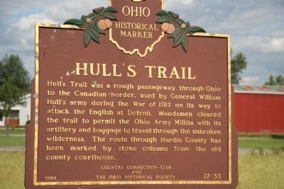
Hullís Trail
Erected 1994 by Country Connection Club and the Ohio Historical Society. (Marker Number 12-33.)
Topics and series. This historical marker is listed in these topic lists: Military • War of 1812. In addition, it is included in the Battlefield Trails - War of 1812, and the Ohio Historical Society / The Ohio History Connection series lists. A significant historical year for this entry is 1812.
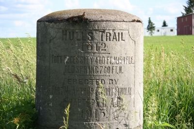
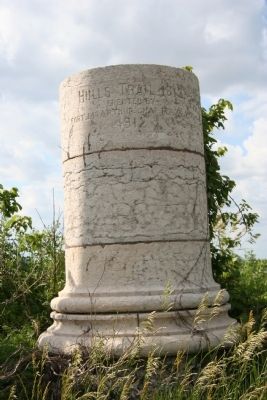
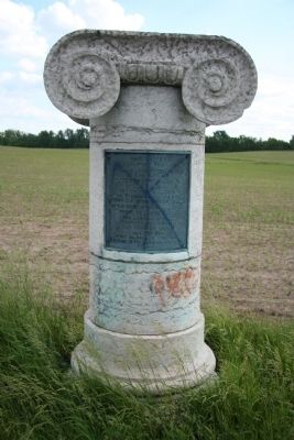
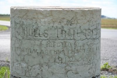
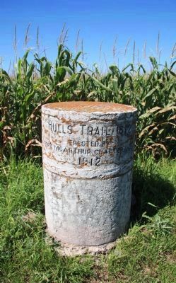
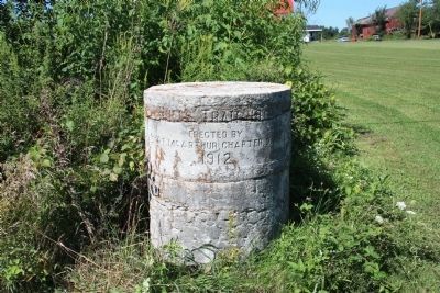
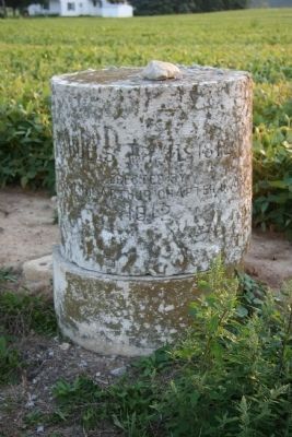
Location. 40° 43.904′ N, 83° 39.254′ W. Marker is near Blanchard, Ohio, in Hardin County. Marker is at the intersection of State Route 701 (Ohio Route 701) and County Road 135 (County Route 135) on State Route 701. Immediately beyond the intersection that is located just east of this historical marker is one of several of the old Hardin County courthouse stone columns that was used by the county leaders back in 1912 to mark the route that Hull used in 1812 as he marched his army northward towards Detroit. Touch for map. Marker is in this post office area: Dunkirk OH 45836, United States of America. Touch for directions.
Other nearby markers. At least 8 other markers are within 5 miles of this marker, measured as the crow flies. Hull's Trail, 1812 (about 400 feet away, measured in a direct line); Dunkirk Veterans Memorial (approx. 3.1 miles away); a different marker also named Hull's Trail, 1812 (approx. 3.4 miles away); To Remember Veterans Of All Wars (approx. 4.1 miles away); a different marker also named To Remember Veterans Of All Wars (approx. 4.3 miles away); This Tablet Marks Hullís Trail; 1812 (approx. 4.7 miles away); Hog-Creek Marsh (approx. 4.8 miles away); Fort McArthur Cemetery (approx. 4.8 miles away).
Regarding Hullís Trail. Shortly before the start of the War of 1812 the American General William Hull, the commander of the American fortification on Michigan's border with Canada (located in Detroit), knew that unless his position was reinforced with additional troops, that his command would be in serious trouble once the war finally got under way. So he took it upon himself to travel down to southern Ohio in order to raise those additional troops.
As soon as General Hull had raised himself an army of soldiers, he began to march northward from Urbana, Ohio. The route that Hull's army took through
Hardin County has been marked by stone columns from the old county courthouse. Pictures and map locations of these markers has been included, in sequence, from south to north.
Related markers. Click here for a list of markers that are related to this marker. Hull's Trail markers.
Also see . . . Hull's Road. This is a link to information provided by Ohio History Central, an online encyclopedia of Ohio History. (Submitted on August 13, 2010, by Dale K. Benington of Toledo, Ohio.)
Photographed By Dale K. Benington, June 17, 2008
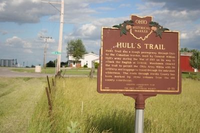
3. Hullís Trail Marker
In the background behind the historical marker is one of several of the old Hardin County courthouse stone columns that was used by the county leaders back in 1912 to mark the route that Hull used in 1812 as he marched his army northward towards Detroit.
Photographed By Dale K. Benington, June 17, 2008
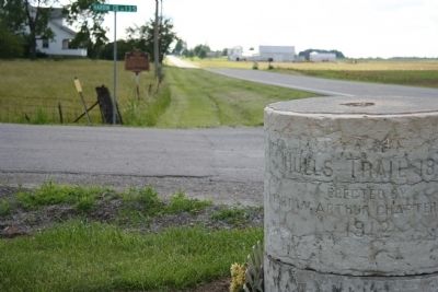
4. Hullís Trail Marker
The trail marker that is in the foreground (with the historical marker in the background) is one of several of the old Hardin County courthouse stone columns that was used by the county leaders back in 1912 to mark the route that Hull used in 1812 as he marched his army northward towards Detroit.
Credits. This page was last revised on May 18, 2022. It was originally submitted on April 30, 2009, by Dale K. Benington of Toledo, Ohio. This page has been viewed 4,828 times since then and 176 times this year. Last updated on May 16, 2022, by Craig Doda of Napoleon, Ohio. Photos: 1, 2, 3, 4, 5, 6, 7. submitted on April 30, 2009, by Dale K. Benington of Toledo, Ohio. 8, 9, 10. submitted on September 3, 2010, by Dale K. Benington of Toledo, Ohio. • Devry Becker Jones was the editor who published this page.
