Near Stephens City in Frederick County, Virginia — The American South (Mid-Atlantic)
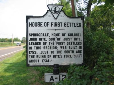
House of First Settler
Inscription.
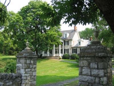
Springdale, home of Colonel John Hite, son of Joist Hite, leader of the first settlers in this section, was built in 1753. Just to the South are ruins of Hite’s Fort, built about 1734.
Erected 1927 by Conservation & Development Commission. (Marker Number A-12.)
Topics and series. This historical marker is listed in these topic lists: Colonial Era • Forts and Castles • Settlements & Settlers. In addition, it is included in the Virginia Department of Historic Resources (DHR) series list. A significant historical year for this entry is 1753.
Location. 39° 6.569′ N, 78° 12.232′ W. Marker is near Stephens City, Virginia, in Frederick County. Marker is at the intersection of Valley Pike (U.S. 11) and Springdale Road (County Route 649), on the right when traveling north on Valley Pike. Just to the north of the bridge over Opequon Creek. Touch for map. Marker is in this post office area: Stephens City VA 22655, United States of America. Touch for directions.
Other nearby markers. At least 8 other markers are within 3 miles of this marker, measured as the crow flies. Second Battle of Winchester (approx. 0.8 miles away); First Battle of Winchester (approx. 0.8 miles away); Stephens City (approx. 1.4 miles away); Hunter's Raid Begins (approx. 2 miles away); Andrew Pitman House (approx. 2 miles away); First Battle of Kernstown (approx. 2 miles away); The Old Graveyard (approx. 2.1 miles away); In Memory of the Many Soldiers of the Revolution (approx. 2.1 miles away). Touch for a list and map of all markers in Stephens City.
Also see . . . Genealogy of the Hite Family. (Submitted on September 2, 2007, by Craig Swain of Leesburg, Virginia.)
Additional commentary.
1. Stones from Hite’s Fort
Some of the stones from Hite’s Fort were used to build a marker in downtown Winchester denoting the actions in the locality related to the French and Indian Wars.
— Submitted September 2, 2007, by Craig Swain of Leesburg, Virginia.
Credits. This page was last revised on December 25, 2019. It was originally submitted on September 2, 2007, by Craig Swain of Leesburg, Virginia. This page has been viewed 2,386 times since then and 95 times this year. Photos: 1, 2. submitted on September 2, 2007, by Craig Swain of Leesburg, Virginia. • J. J. Prats was the editor who published this page.

