Chilesburg in Caroline County, Virginia — The American South (Mid-Atlantic)
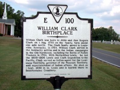
William Clark Birthplace
Erected 1995 by Department of Historic Resources. (Marker Number E-100.)
Topics and series. This historical marker is listed in these topic lists: Cemeteries & Burial Sites • Exploration • Wars, US Indian. In addition, it is included in the Lewis & Clark Expedition, and the Virginia Department of Historic Resources (DHR) series lists. A significant historical date for this entry is September 1, 1838.
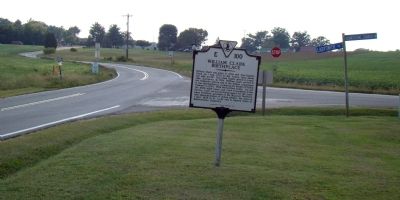
Location. 38° 0.084′ N, 77° 35.034′ W. Marker is in Chilesburg, Virginia, in Caroline County. Marker is at the intersection of Ladysmith Road (County Route 639) and Countyline Church Road (County Route 603), on the right when traveling east on Ladysmith Road. Touch for map. Marker is at or near this postal address: 3461 Ladysmith Road, Ruther Glen VA 22546, United States of America. Touch for directions.
Other nearby markers. At least 8 other markers are within 7 miles of this marker, measured as the crow flies. Clark Family Farm (approx. 3.9 miles away); Maneuvering to the North Anna River (approx. 3.9 miles away); York: Lewis and Clark Expedition (approx. 3.9 miles away); Dickinson's Mill (approx. 4˝ miles away); Golansville Quaker Meetinghouse (approx. 4.8 miles away); Beaver Dam School (approx. 5.6 miles away); The Depot at Beaver Dam (approx. 5.6 miles away); Nancy Wright’s (approx. 6.9 miles away).
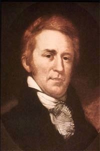
Also see . . . William Clark (explorer). Wikipedia entry. “Clark did not have any formal education, but like many of his contemporaries he was tutored at home. In later years, he was somewhat self-conscious about his convoluted grammar and inconsistent spelling—he spelled “Sioux” twenty-seven different ways in his journals of the Lewis and Clark Expedition—and sought to have his journals corrected before publication. But the spelling of American English was not standardized in Clark’s youth, and his vocabulary suggests that he was well read.” (Submitted on September 20, 2009.)
Credits. This page was last revised on December 24, 2019. It was originally submitted on September 19, 2009, by J. J. Prats of Powell, Ohio. This page has been viewed 2,567 times since then and 84 times this year. Photos: 1, 2. submitted on September 19, 2009, by J. J. Prats of Powell, Ohio. 3. submitted on September 20, 2009, by J. J. Prats of Powell, Ohio.


