Near Moss Neck in Caroline County, Virginia — The American South (Mid-Atlantic)
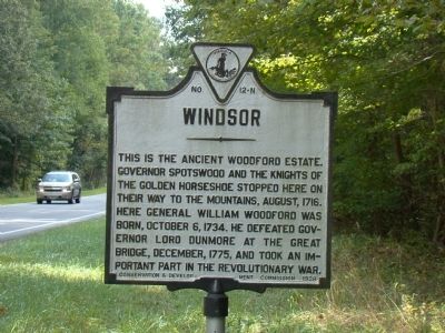
Windsor
Erected 1928 by Conservation & Development Commission. (Marker Number N-12.)
Topics and series. This historical marker is listed in these topic lists: Colonial Era • Exploration • War, US Revolutionary. In addition, it is included in the Virginia Department of Historic Resources (DHR) series list. A significant historical month for this entry is October 1862.
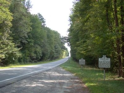
Location. 38° 12.867′ N, 77° 17.733′ W. Marker is near Moss Neck, Virginia, in Caroline County. Marker is on U.S. 17, half a mile south of Ware Creek Road, on the right when traveling south. Touch for map. Marker is in this post office area: Rappahannock Academy VA 22538, United States of America. Touch for directions.
Other nearby markers. At least 8 other markers are within 5 miles of this marker, measured as the crow flies. Skinker’s Neck (a few steps from this marker); The Third Lederer Expedition (approx. 0.6 miles away); Jackson's Headquarters (approx. 1.1 miles away); Rappahannock Academy (approx. 2.9 miles away); Lamb’s Creek Church (approx. 3½ miles away); Stafford County / King George County (approx. 4 miles away); Caroline County / Spotsylvania County (approx. 4.3 miles away); Hazelwood (approx. 4½ miles away). Touch for a list and map of all markers in Moss Neck.
Related markers. Click here for a list of markers that are related to this marker. They follow the path of the Knights of the Golden Horseshoe
Also see . . .
1. General William Woodford (1734–1780) of Caroline, USA. from A history of the Woodforde Family from 1300. “Under cover of night. Dunmore began to send troops along the narrow bridge which connected the fort to the mainland in an attempt to surprise the Virginians. Under Woodford’s orders, the colonists opened fire in the direction of the bridge. The redcoats were cut down and their bodies fell into the dismal swamp on either side of the narrow gangplank. This was the first battle of the Revolution to be fought on Virginia soil.” (Submitted on September 20, 2009.)
2. Windsor. “In 1716, Governor Spotswood organized a party, cornprised of some Williamsburg gentlemen, to explore the Shenandoah Valley. Late in the summer, the party left Williamsburg and spent their second night at the home of Robert Beverley. Joined by Beverley, the party left at sun-up for Windsor, the home of William Woodford. From The Park to Windsor, the distance was only 20 miles—but with a road ‘in name only.’ The trail was obstructed on every side by fallen trees and dense undergrowth. The trip consumed nine hours before the party reached Windsor which overlooked the Rappahannock River Valley, (The reader must remember that the Rappahannock River was much larger and followed a slightly different course than it does today). From all indications, the party, in order to reach Windsor, had to travel through what is now Ft. A. P. Hi1l. They must have entered the post near Christopher’s Fork (on the southern boundary of the post) and followed the winding, general direction of Reservation Road 608 as far as what was once a county school (Mica) and is now known as the Heth area. They must then have turned east on Reservation Road 607 to Pullers Corner, and then veered north along 607 to the home of General Woodford (this area, later, was referred to as the Moss Neck area). ... General Woodford [Revolutionary War’s General William Woodford’s father] joined the party...” (Submitted on September 20, 2009.)
3. Brigadier-General William Woodford. Entry in 1852 Washington and the Generals of the American Revolution, Volume I. “He accepted the commission, and assumed the command of the Virginia regiment. In the battle of Brandywine he was wounded in the hand, so as to be compelled for a few days to leave camp. He was in the battle of Monmouth, and in December, 1779, was ordered south. He was among the prisoners taken by the British at Charleston on the 12th of May, 1780, and being taken to New York in that summer, died there, on the 13th of November, in the thirty-sixth year of his age.” (Submitted on September 20, 2009.)
Credits. This page was last revised on June 16, 2016. It was originally submitted on September 20, 2009, by J. J. Prats of Powell, Ohio. This page has been viewed 1,543 times since then and 59 times this year. Photos: 1, 2. submitted on September 20, 2009, by J. J. Prats of Powell, Ohio.

