Boise in Ada County, Idaho — The American West (Mountains)
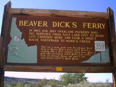
Beaver Dick's Ferry
They cut a steep grade from the Oregon Trail down to Beaver Dick's Ferry, which served a crossing only a short distance below here. After gold rush excitement ended, Idaho City traffic came on through Boise and used a toll road further north to Boise Basin.
Erected by Idaho Historical Society. (Marker Number 359.)
Topics and series. This historical marker is listed in this topic list: Settlements & Settlers. In addition, it is included in the Idaho State Historical Society, and the Oregon Trail series lists. A significant historical year for this entry is 1863.
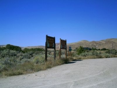
Location. 43° 33.074′ N, 116° 5.93′ W. Marker is in Boise, Idaho, in Ada County. Marker is on Warm Springs Avenue (at milepost 7), 0.1 miles Highland Valley Road, on the left when traveling north. Touch for map. Marker is in this post office area: Boise ID 83716, United States of America. Touch for directions.
Other nearby markers. At least 8 other markers are within walking distance of this marker. The Oregon Trail (here, next to this marker); Ezra Meeker (approx. 0.8 miles away); Fort Boise (approx. 0.8 miles away); Idaho's Emigrant Trails (approx. 0.8 miles away); Bonneville Point (approx. 0.8 miles away); Kelton Road (approx. 0.8 miles away); "Our Road Was Very Steep…" (approx. 0.9 miles away); Diversion Dam (approx. 0.9 miles away). Touch for a list and map of all markers in Boise.
Credits. This page was last revised on June 16, 2016. It was originally submitted on September 22, 2009, by Rebecca Maxwell of Boise, Idaho. This page has been viewed 3,569 times since then and 148 times this year. Photos: 1, 2. submitted on September 22, 2009, by Rebecca Maxwell of Boise, Idaho. • Craig Swain was the editor who published this page.

