Sandy Hook in Middletown Township in Monmouth County, New Jersey — The American Northeast (Mid-Atlantic)
200 Years of Service
Aids to Navigation
— Maritime History —
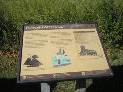
From the first federally funded lifesaving stations built in 1849 to today’s busy bases, the history of the United States Coast Guard can be traced along New Jersey’s coast.
In 1915, the Life-Saving Marine Service were combined to form the U.S. Coast Guard. The new federal agency eventually assumed the combined responsibilities of the Steamboat Inspection Service, the Lighthouse Service, and the Bureau of Navigation as well. Coast Guard missions today revolve around maritime safety, navigational security, law enforcement, and marine environment protection.
“You have to go out, but nothing says you have to come back,” was the unofficial motto of the United States Life-Saving Service, and stands as a reminder to the vital job of today’s Coast Guard.
Life-Saving Service Stations
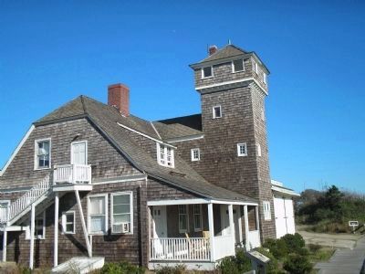
Driving along the New Jersey Coastal Heritage Trail you will find active Coast Guard stations, some still using their inherited Life-Saving Service buildings, while others have constructed modern-day structures and facilities. Many of these 19th century Life-Saving Service stations have also been converted for use as private homes and offices. Their distinctive shapes add interest to the coastal landscape. The Duluth style, seen below, is one of two common types found along the Jersey Shore.
Erected by National Park Service, U.S. Department of the Interior; State of New Jersey Division of Parks & Forestry.
Topics. This historical marker is listed in these topic lists: Military • Waterways & Vessels. A significant historical year for this entry is 1849.
Location. 40° 27.894′ N, 74° 0.41′ W. Marker is in Middletown Township, New Jersey, in Monmouth County. It is in Sandy Hook. Marker is on Gateway NRA Road, on the left when traveling north. Marker is in the Fort Hancock Historic District in the Sandy Hook Unit of Gateway National Recreation Area. Touch for map. Marker is at or near this postal address: 35 Hartshorne Dr, Highlands NJ 07732, United States of America. Touch for directions.
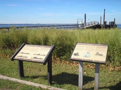
Other nearby markers. At least 8 other markers are within walking distance of this marker. Protecting American Coasts (here, next to this marker); Army Docks (a few steps from this marker); Ferry Landing and Chapel (about 300 feet away, measured in a direct line); Officers Row (about 300 feet away); Post Chapel (about 300 feet away); Rodman Gun (about 400 feet away); Mule Barn (about 400 feet away); Fire House Number 1 (about 400 feet away). Touch for a list and map of all markers in Middletown Township.
More about this marker. Pictures of old time and modern ships appear on the bottom of the marker, with a caption of “From lifeboats and sailing ships to modern high-speed rescue and law enforcement cutters, Coast Guard vessels
keep pace with advancing marine technology.”
Also see . . . New Jersey Coastal Heritage Trail Route. National Park Service website. (Submitted on September 23, 2009, by Bill Coughlin of Woodland Park, New Jersey.)
Credits. This page was last revised on February 7, 2023. It was originally submitted on September 23, 2009, by Bill Coughlin of Woodland Park, New Jersey. This page has been viewed 693 times since then and 10 times this year. Photos: 1, 2, 3, 4. submitted on September 23, 2009, by Bill Coughlin of Woodland Park, New Jersey.


