Near Winchester in Frederick County, Virginia — The American South (Mid-Atlantic)
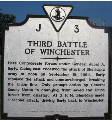
Third Battle of Winchester
Erected 1988 by Department of Conservation and Historic Resources. (Marker Number J-3.)
Topics and series. This historical marker is listed in this topic list: War, US Civil. In addition, it is included in the Virginia Department of Historic Resources (DHR) series list. A significant historical month for this entry is September 1732.
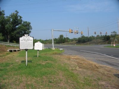
Location. 39° 11.285′ N, 78° 6.734′ W. Marker is near Winchester, Virginia, in Frederick County. Marker is at the intersection of Berryville Pike (Virginia Route 7) and Greewood Road (County Route 656), on the right when traveling east on Berryville Pike. Touch for map. Marker is at or near this postal address: 2098 Berryville Pike, Winchester VA 22601, United States of America. Touch for directions.
Other nearby markers. At least 8 other markers are within walking distance of this marker. Jost Hite and Winchester (here, next to this marker); a different marker also named Third Battle of Winchester (approx. 0.4 miles away); The Union Attacks (approx. 0.4 miles away); Sheridan Moves To Battle (approx. half a mile away); Captain Robert Young Conrad (approx. 0.7 miles away); a different marker also named Third Battle of Winchester (approx. 0.7 miles away); a different marker also named The Third Battle of Winchester (approx. 0.8 miles away); Grover's Attack (approx. 0.9 miles away). Touch for a list and map of all markers in Winchester.
Regarding Third Battle of Winchester. This marker replaces a previous J 3 with the same title, but which stood on US 522 further south, at the east entrance to Winchester. The only major difference was the use of the label “Unionists” instead of “Union Forces” in the text.
Also see . . .
1. Virtual Tour of the Third Winchester Battlefield. Included is a panorama of the exit of Berryville Canyon. (Submitted on September 3, 2007, by Craig Swain of Leesburg, Virginia.)
2. Third Battle of Winchester or Opequon. From the National Park Service survey of battlefields in the Shenandoah Valley. (Submitted on September 3, 2007, by Craig Swain of Leesburg, Virginia.)
3. Biography of Emory Upton
. Upton was one of the rising stars of the Union Army by late 1864. Seen as a tactical visionary, Upton went on to write the definitive tactics manuals for the Army in the post war period. (Submitted on September 3, 2007, by Craig Swain of Leesburg, Virginia.)

Photographed By Craig Swain, August 25, 2007
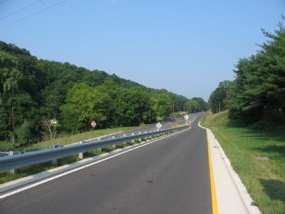
3. Berrville Canyon
Looking west toward Winchester. On the morning of September 19, 1864, Maj. Gen. Philip H. Sheridan marched the bulk of his command up the Berryville Turnpike (now Virginia Route 7) towards Lt. Gen. Jubal Early's Army of the Valley at Winchester. The canyon was a perfect place to bottle up Sheridan's advance, but only a few pickets guarded the western entrance. Still, the Federal advance was slowed as the supporting wagon trains held up the march.
Credits. This page was last revised on February 26, 2020. It was originally submitted on September 3, 2007, by Craig Swain of Leesburg, Virginia. This page has been viewed 4,646 times since then and 20 times this year. Photos: 1, 2, 3. submitted on September 3, 2007, by Craig Swain of Leesburg, Virginia. • J. J. Prats was the editor who published this page.

