Kent in Putnam County, New York — The American Northeast (Mid-Atlantic)
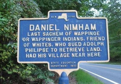
Daniel Nimham
Last sachem of Wappinoe
or Wappinger Indians, friend
of whites, who sued Adolph
Philipse to retrieve land.
Had his village here.
State Education Department 1932
Erected 1932 by State Education Department.
Topics. This historical marker is listed in these topic lists: Native Americans • Notable Places. A significant historical year for this entry is 1932.
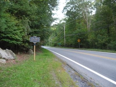
Location. 41° 28.312′ N, 73° 45.612′ W. Marker is in Kent, New York, in Putnam County. Marker is on Carmel-Kent Cliffs Road, 0.1 miles north of Nimham Road, on the left when traveling south. Located in front of the Kent Volunteer Fire Department. Touch for map. Marker is in this post office area: Carmel NY 10512, United States of America. Touch for directions.
Other nearby markers. At least 8 other markers are within 4 miles of this marker, measured as the crow flies. Union Cemetery (approx. 0.7 miles away); One Room School Dist. #3 (approx. 2 miles away); Those who Served our Country Buried in Farmers Mills Area Cemeteries (approx. 2.6 miles away); Site of House of Solomon Hopkins (approx. 3.2 miles away); Putnam County Veterans Monument (approx. 3.3 miles away); M-60A3 Main Battle Tank (approx. 3.3 miles away); Cobra AH-1G/S/F Helicopter (approx. 3.3 miles away); Putnam County's First Park (approx. 3.4 miles away).
Also see . . .
1. Daniel Nimhan. Wikipedia biography of Daniel Nimham. (Submitted on September 28, 2009.)
2. Colonial Fredericksburg. "Colonial Fredericksburg was the ancestral home of the Wappinger Indians. Chief Daniel Nimham, Sachem of the Wappingers, led his people to the aid of the British during the French & Indian Wars. While he and his men were fulfilling their service to the Crown, with Rogers Rangers, the Philippse family, who previously bought the area now known as Cold Spring and Philippstown, presented a forged Bill of Sale claiming they owned all the land to the Connecticut border, including all of Colonial Fredericksburg. With the help of William Slaughter, who attacked the Wappingers (and whose name became associated with attacking defenseless people), the tribe were forced to relocate to the Indian Village at Stockbridge, Massachusetts. Upon returning from the war, Daniel Nimham went to court and fought for his people's land. The courts realized the Bill of Sale was forged and tried to stop Nimham's case from going forward. The imprisoned anyone assisting Nimham. Nimham fought for years, taking his case all the way to England." (Submitted on September 28, 2009.)
Credits. This page was last revised on June 16, 2016. It was originally submitted on September 24, 2009, by Michael Herrick of Southbury, Connecticut. This page has been viewed 1,091 times since then and 13 times this year. Photos: 1, 2. submitted on September 24, 2009, by Michael Herrick of Southbury, Connecticut. • Syd Whittle was the editor who published this page.

