Near Frederick in Frederick County, Maryland — The American Northeast (Mid-Atlantic)
Jug Bridge
An engineering marvel for early America
— The Historic National Road - The Road That Built The Nation —
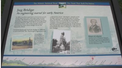
In 1800, travelers expected to ford rivers or use ferries that were slow and often risky in bad weather. The Baltimore and Frederick-Town Turnpike Company, building the first leg of the National Road in 1805, set out to revolutionize American roads. One of the results was an amazing five-arch stone bridge across the Monocacy River.
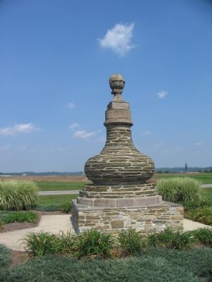
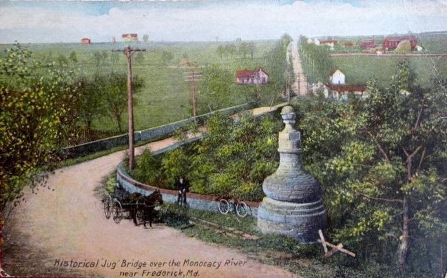
Leonard Harbaugh built the bridge in 1808 for a cost of $55,000. Mr. Harbaugh's signature was a distinctive stone "demijohn" placed on the bridge's east end, giving the span its name the "Jug Bridge." A demijohn was a popular bulbous, thin-necked bottle that often held whiskey. Rumors persist that a real jug of whiskey was planted inside the stone version. The Jug Bridge served faithfully well into the automobile era, but a collapse in 1942 led to a new bridge.
(Sidebar):
Marquis de Lafayette
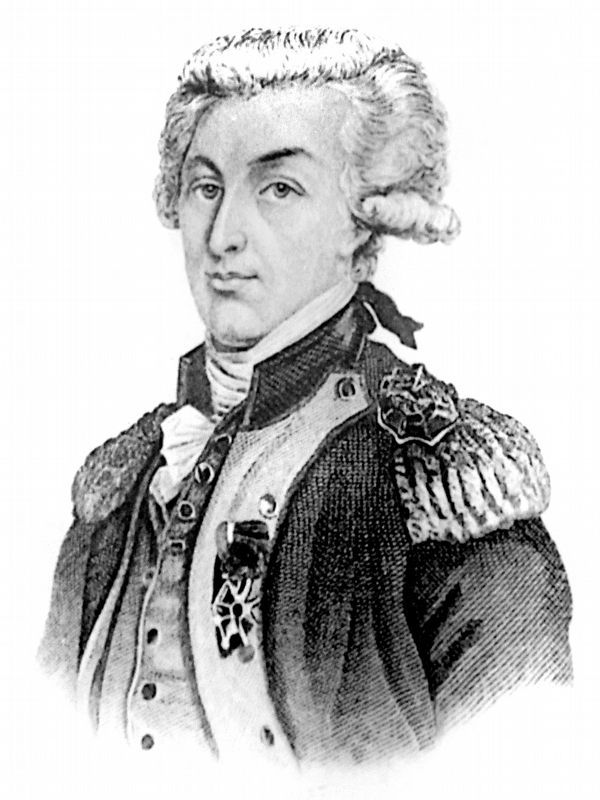
America's hero, Frenchman Marquis de Lafayette, crossed the Jug Bridge in December, 1824, entering Frederick on his triumphal U.S. tour fifty years after the Revolutionary War.
Erected by America's Byways.
Topics and series. This historical marker is listed in these topic lists: Bridges & Viaducts • Roads & Vehicles. In addition, it is included in the Lafayette’s Farewell Tour, and the The Historic National Road series lists. A significant historical month for this entry is December 1824.
Location. This marker has been replaced by another marker nearby. It was located near 39° 24.305′ N, 77° 23.019′ W. Marker was near Frederick, Maryland, in Frederick County. Marker was at the intersection of Bowman’s Farm Road and Patrick Street (Maryland Route 144), on the right when traveling east on Bowman’s Farm Road. Just west of the overpass of I-70 / U.S. 40. In a pull off area between the interstate, Bowman Road, and Patrick Street. Touch for map. Marker was in this post office area: Frederick MD 21705, United States of America. Touch for directions.
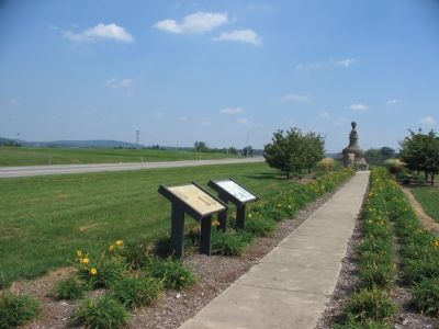
Other nearby markers. At least 8 other markers are within 2 miles of this location, measured as the crow flies. A different marker also named Jug Bridge (here, next to this marker); General LaFayette (within shouting distance of this marker); The Frederick Brick Works (approx. 1.2 miles away); The Lower Depot Neighborhood / The Frederick Brick Works (approx. 1.2 miles away); The Frederick County History Bell (approx. 1.3 miles away); Gen. Bradley T. Johnson (approx. 1.3 miles away); The Everedy Company (approx. 1.3 miles away); Tanneries (approx. 1.4 miles away). Touch for a list and map of all markers in Frederick.
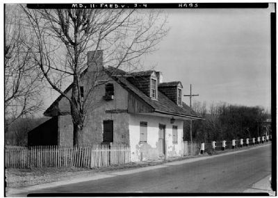
More about this marker. On the left side is a picture of a post card captioned, “The Jug Bridge as seen in this early 20th century postcard view. The bridge collapsed in 1942, but the tollhouse on the opposite side of the river, still survives and is now a private residence.”
In the center is a picture of the Jug Bridge monument captioned, “Some horseless carriage adventurers (note the googgles and the duster in the foreground) pose with the stone demijohn at the entrance to the Jug Bridge. The unique monument was moved to its present location in 1965.”
The sidebar contains a portrait of Lafayette.
The background of the marker is “National Road at Fairview Inn” which is used on many of the markers in this series.
Related marker. Click here for another marker that is related to this marker. This marker has been replaced with the linked marker.
Also see . . .
1. Jug Bridge site. Route 40 website entry (Submitted on March 2, 2022, by Larry Gertner of New York, New York.)
2. Marquis de Lafayette 1757 - 1834. Virtualology website entry (Submitted on September 5, 2007, by Craig Swain of Leesburg, Virginia.)
Photographed By Craig Swain, September 9, 2007
4. The Old Bridge(s)
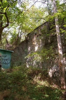
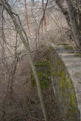
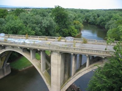
Three generations of bridges are in evidence at the Jug Bridge site. This photograph was taken from the current Old National Pike bridge (Route 144). The old highway bridge dating to the 1940s still stands to the north, but is not used for traffic. Some stone piling ruins lay further to the north of that bridge, dating to the original Jug Bridge. The original spanned the river to connect what are present day East Patrick Street and Dr. Baxter Road. The site is on private property.
Library of Congress
5. The Jug Bridge in 1933
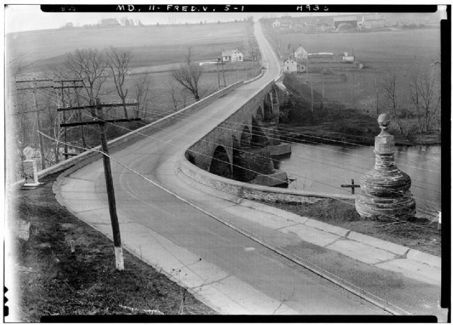
In this 1933 photo, clearly visible on the east end of the bridge is the Jug Monument. On the far bank is the toll house and even further in the distance is the Reich farm house and barn.
Credit: Library of Congress, Prints and Photographs Division, Historic American Buildings Survey, HABS MD,11-FRED.V,5-1
Credit: Library of Congress, Prints and Photographs Division, Historic American Buildings Survey, HABS MD,11-FRED.V,5-1
Credits. This page was last revised on March 24, 2024. It was originally submitted on September 5, 2007, by Craig Swain of Leesburg, Virginia. This page has been viewed 5,901 times since then and 137 times this year. Photos: 1, 2, 3. submitted on September 5, 2007, by Craig Swain of Leesburg, Virginia. 4. submitted on September 11, 2007, by Craig Swain of Leesburg, Virginia. 5. submitted on December 9, 2007, by Craig Swain of Leesburg, Virginia. 6. submitted on July 19, 2019, by Allen C. Browne of Silver Spring, Maryland. 7. submitted on November 12, 2015. 8, 9. submitted on January 17, 2008, by Christopher Busta-Peck of Shaker Heights, Ohio. 10, 11. submitted on February 20, 2008, by Christopher Busta-Peck of Shaker Heights, Ohio. 12. submitted on January 17, 2008, by Christopher Busta-Peck of Shaker Heights, Ohio. • J. J. Prats was the editor who published this page.
