Seneca Rocks in Pendleton County, West Virginia — The American South (Appalachia)
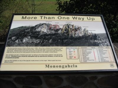
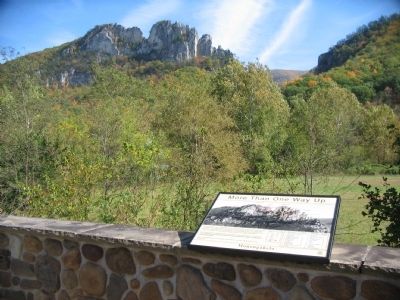
More Than One Way Up
Non-climbers can get a "climber's eye-view" by hiking up to the observation platform near the North Summit. Climbing routes should be attempted only by experienced climbers, or with the aid of experienced guides.
Can you find climbers on any of the popular routes shown on this map? Which peak has more difficult routes?
Erected by Monongahela National Forest.
Topics. This historical marker is listed in this topic list: Natural Features. A significant historical year for this entry is 1939.
Location. 38° 50.026′ N, 79° 22.451′ W. Marker is in Seneca Rocks, West Virginia, in Pendleton County. Marker can be reached from the intersection of State Highway 28/55 and Roy Gap Road, on the right when traveling north. Located at the Seneca Rocks Discovery Center in Monogahela National Forest. Touch for map. Marker is in this post office area: Seneca Rocks WV 26884, United States of America. Touch for directions.
Other nearby markers. At least 8 other markers are within 6 miles of this marker, measured as the crow flies. 10th Mountain Division (within shouting distance of this marker); Sites Homestead (approx. 0.2 miles away); An 1800’s Garden! (approx. 0.2 miles away); A Melting Pot House (approx. 0.2 miles away); Camp Luther (approx. 1.3 miles away); Eagle Rocks (approx. 4.4 miles away); St. George’s Church (approx. 5.4 miles away); Champe Rocks (approx. 5˝ miles away). Touch for a list and map of all markers in Seneca Rocks.
Also see . . .
1. Seneca Rocks Discovery Center. (Submitted on October 13, 2009, by Craig Swain of Leesburg, Virginia.)
2. The Legend of Seneca Rocks. (Submitted on October 13, 2009, by Craig Swain of Leesburg, Virginia.)
Credits. This page was last revised on June 16, 2016. It was originally submitted on October 13, 2009, by Craig Swain of Leesburg, Virginia. This page has been viewed 914 times since then and 13 times this year. Photos: 1, 2, 3. submitted on October 13, 2009, by Craig Swain of Leesburg, Virginia.


