Lewiston in Nez Perce County, Idaho — The American West (Mountains)
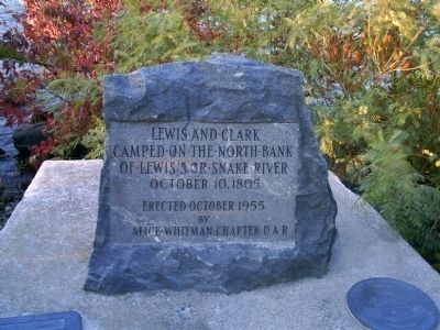
Lewis and Clark
Erected October 1955
by Alice Whitman Chapter D.A.R.
Erected 1955 by Alice Whitman Chapter D.A.R.
Topics and series. This historical marker is listed in this topic list: Exploration. In addition, it is included in the Daughters of the American Revolution, and the Lewis & Clark Expedition series lists. A significant historical date for this entry is October 10, 1780.
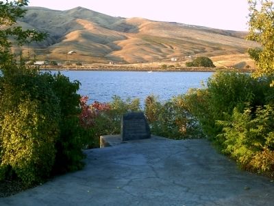
Location. 46° 25.473′ N, 117° 2.034′ W. Marker is in Lewiston, Idaho, in Nez Perce County. Marker can be reached from Dike Bypass. Marker is located near downtown Lewiston on a footpath over the Dike Bypass that runs along the rivers. This Lewis & Clark Interpretive Center provides information about the expedition at the confluence of the Snake and Clearwater Rivers. Touch for map. Marker is in this post office area: Lewiston ID 83501, United States of America. Touch for directions.
Other nearby markers. At least 8 other markers are within walking distance of this marker. Lewiston's Chinese Community (about 800 feet away, measured in a direct line); Tsceminicum (approx. 0.2 miles away); Firsts in Lewiston (approx. ¼ mile away); Site of Luna House (approx. ¼ mile away); Old City Hall (approx. ¼ mile away); a different marker also named Lewis and Clark (approx. ¼ mile away); Pacific Northwest Bell Building (Historic Name) (approx. ¼ mile away); Kettenbach Building (approx. ¼ mile away). Touch for a list and map of all markers in Lewiston.
Regarding Lewis and Clark. The Lewis and Clark Expedition crossed over the formidable Bitterroot Mountains of north central Idaho. They were rescued and befriended by Nez Perce Indians in the area. After camping near the confluence of the Snake River and Clearwater River, they continued their journey westward to the Pacific Ocean. The present day cities of Lewiston, Idaho and Clarkston, Washington are named after the leaders of the famous expedition.
Credits. This page was last revised on June 16, 2016. It was originally submitted on October 13, 2009, by Rebecca Maxwell of Boise, Idaho. This page has been viewed 1,958 times since then and 16 times this year. Photos: 1, 2, 3. submitted on October 13, 2009, by Rebecca Maxwell of Boise, Idaho. • Craig Swain was the editor who published this page.


