Warwick Township near Warminster in Bucks County, Pennsylvania — The American Northeast (Mid-Atlantic)
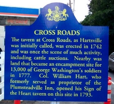
Cross Roads
Topics. This historical marker is listed in these topic lists: Industry & Commerce • Roads & Vehicles • Settlements & Settlers • War, US Revolutionary. A significant historical year for this entry is 1742.
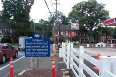
Location. 40° 13.689′ N, 75° 5.669′ W. Marker is near Warminster, Pennsylvania, in Bucks County. It is in Warwick Township. Marker is at the intersection of Bristol Road and Old York Road, on the right when traveling west on Bristol Road. Touch for map. Marker is at or near this postal address: 1075 W Bristol Rd, Warminster PA 18974, United States of America. Touch for directions.
Other nearby markers. At least 8 other markers are within 3 miles of this marker, measured as the crow flies. John Kulick and Tristan Smith (about 600 feet away, measured in a direct line); Independence Hall Stones (about 600 feet away); 9/11 NYC Emergency Responders' Memorial (about 600 feet away); Moland House (approx. half a mile away); Welcome to the Moland House (approx. 0.6 miles away); Early Life on the Moland Farm (approx. 0.6 miles away); Log College (approx. one mile away); Warminster Community Park-Sandpiper (approx. 2.6 miles away). Touch for a list and map of all markers in Warminster.
More about this marker. Marker is in the style of Pennsylvania Historical and Museum Commission historical markers but was apparently erected by the owner of the gas station on the adjacent property.
Credits. This page was last revised on February 7, 2023. It was originally submitted on October 15, 2009, by William Fischer, Jr. of Scranton, Pennsylvania. This page has been viewed 1,499 times since then and 73 times this year. Photos: 1, 2, 3. submitted on October 15, 2009, by William Fischer, Jr. of Scranton, Pennsylvania.


