Ridgefield in Fairfield County, Connecticut — The American Northeast (New England)
The Battle of Ridgefield, April 27, 1777
Ridgefield, Connecticut
— The Museum in the Streets —
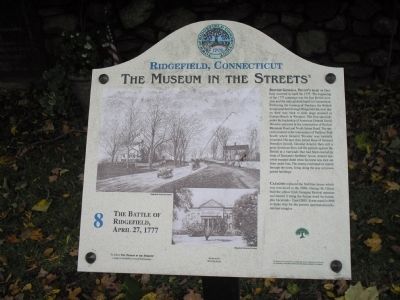
British General Tryon’s Raid on Danbury occurred on April 26, 1777. The beginning of the 1777 campaign was the first British invasion and the only pitched battle in Connecticut. Following the burning of Danbury the British troops marched through Ridgefield the next day on their way back to their ships moored at Compo Beach in Westport. The first skirmish, under the leadership of American General David Wooster occurred at the intersection of Barlow Mountain Road and North Salem Road. The second occurred at the intersection of Tackora Trail South where General Wooster was mortally wounded. His men then joined those of General Benedict Arnold. General Arnold, then still a great American hero, led the patriots against the British at a barricade that had been erected in front of Benjamin Stebbins’ house. Arnold narrowly escaped death when his horse was shot out from under him. The enemy continued its march through the town, firing along the way at known patriot buildings.
Casagmo replaced the Stebbins house which was torn down in the 1890s. George M. Olcott built the yellow brick Georgian mansion and named it using the Italian word for house, plus his initials – Casa GMO. It was razed in 1968 to make way for the present apartment/condominium complex.
Erected by The Museum in the Streets®. (Marker Number 8.)
Topics and series. This historical marker is listed in this topic list: War, US Revolutionary. In addition, it is included in the The Museum in the Streets®: Ridgefield, Connecticut series list. A significant historical month for this entry is April 1713.
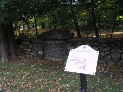
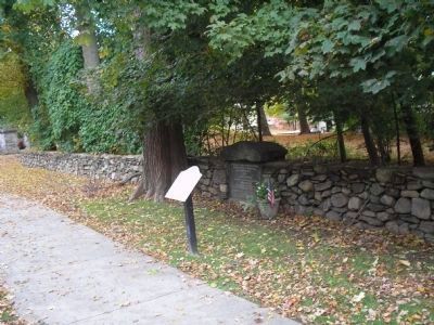
Location. 41° 17.204′ N, 73° 29.94′ W. Marker is in Ridgefield, Connecticut, in Fairfield County. Marker is on Main Street, on the right when traveling north. Marker is located on the south side of the entrance to Casagmo condominiums. Touch for map. Marker is in this post office area: Ridgefield CT 06877, United States of America. Touch for directions.
Other nearby markers. At least 8 other markers are within walking distance of this marker. Battle of Ridgefield Dead (a few steps from this marker); a different marker also named Battle of Ridgefield (a few steps from this marker); The Gilbert House (about 300 feet away, measured in a direct line); The Elms Inn and Stebbins Homestead (about 600 feet away); a different marker also named The Battle of Ridgefield (approx. 0.2 miles away); Ridgefield (approx. ¼ mile away); Smith Tavern – A Colonial Meeting Place (approx. ¼ mile away); Ballard Park (approx. ¼ mile away). Touch for a list and map of all markers in Ridgefield.
More about this marker. Two photos provided by the idgefield Historical Society appear on the marker. One depicts Town Street (now Main Street) at the time of the battle, and the other is of the Stebbins House.
Related markers. Click here for a list of markers that are related to this marker. Take the Museum in the Streets Walking Tour in Ridgefield, Connecticut.
Also see . . .
1. Battle of Ridgefield. Wikipedia entry (Submitted on July 7, 2021, by Larry Gertner of New York, New York.)
2. Battle of Ridgefield. Keeler Tavern Museum website entry (Submitted on July 7, 2021, by Larry Gertner of New York, New York.)
Credits. This page was last revised on November 25, 2021. It was originally submitted on October 17, 2009, by Bill Coughlin of Woodland Park, New Jersey. This page has been viewed 2,915 times since then and 55 times this year. Photos: 1, 2, 3, 4. submitted on October 17, 2009, by Bill Coughlin of Woodland Park, New Jersey.


