Near Mabie in Randolph County, West Virginia — The American South (Appalachia)
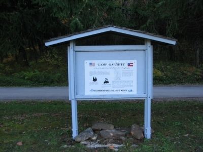
Camp Garnett
Rich Mountain Battlefield Civil War Site
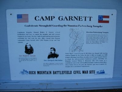
Confederate Stronghold Guarding the Staunton-Parkersburg Turnpike
Confederate Brigadier General Robert S. Garnett ordered fortifications built here to control the turnpike and hold western Virginia for the South. The fort, built of earth and log entrenchments, overlooked the vital road. By July, 1861, Colonel John Pegram commanded Camp Garnett with 1,300 Virginia troops and four cannon.
Union Major General George B. McClellan was charged with securing western Virginia for the Union. On July 9, 1861, he brought over 5,000 troops to Roaring Creek Flats, two miles west of Camp Garnett. Hesitant to attack the well-entrenched Confederate position, McClellan sent Brigadier General William S. Rosecrans with 1,917 troops on a roundabout route to the south up Rich mountain. Guided by David Hart, whose family lived at the pass, the Federals' goal was to capture the turnpike above and behind Camp Garnett.
Gen. Robert S. Garnett
was killed at Corrick's Ford while retreating from his former position at Laurel Hill. He was the first Civil War general to fall in battle.
Gen. George B. McClellan
was called to Washington to lead the federal Army of the Potomac as a result of the victory at Rich Mountain.
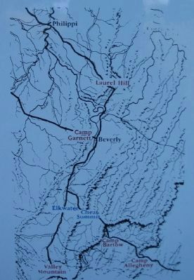
Staunton-Parkersburg Turnpike
connected the Shenandoah Valley with the Ohio River and gave access to the vital B&O railroad. The battle to control western Virginia began at Philippi, with Union victory secured at Rich Mountain and Corrick's Ford. During the remainder of 1861, Union troops at Cheat Summit Fort faced off against Confederates at Camp Barlow, then Camp Allegheny, but Federal forces remained in control of the strategic road.
Topics. This historical marker is listed in this topic list: War, US Civil. A significant historical month for this entry is July 1861.
Location. 38° 52.207′ N, 79° 57.359′ W. Marker is near Mabie, West Virginia, in Randolph County. Marker is on Rich Mountain Road / Files Creek Road (County Route 37/8), on the right when traveling west. Located in the Rich Mountain Battlefield's Camp Garnett section. Touch for map. Marker is in this post office area: Mabie WV 26278, United States of America. Touch for directions.
Other nearby markers. At least 8 other markers are within 2 miles of this marker, measured as the crow flies. General George B. McClellan (a few steps from this marker); Staunton-Parkersburg Turnpike (within shouting distance of this marker); Fortifications (about 300 feet away, measured in a direct line); Artillery (about 300 feet away); a different marker also named Camp Garnett (about 300 feet away); Welcome to Rich Mountain Battlefield (approx. 1.2 miles away); Rich Mountain (approx. 1.2 miles away); Battle of Rich Mountain (approx. 1.2 miles away). Touch for a list and map of all markers in Mabie.
More about this marker. On the left are portraits of Gens. Garnett and McClellan. On the right is a map of the portion of West Virginia described in the text, with the turnpike and other place names mentioned indicated.
Also see . . . Rich Mountain Battlefield. An overview of the battle. (Submitted on October 25, 2009, by Craig Swain of Leesburg, Virginia.)

Photographed By Craig Swain, October 11, 2009
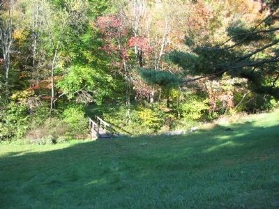
4. Trail Over Roaring Creek
Looking out from the parking area at the bridge over Roaring Creek. Confederate trenches defended the high ground on the opposite side. In 1861, much of the hill side was bare pastures and many existing trees were felled for the defensive works.
Credits. This page was last revised on September 14, 2020. It was originally submitted on October 25, 2009, by Craig Swain of Leesburg, Virginia. This page has been viewed 1,083 times since then and 30 times this year. Last updated on September 13, 2020, by Bradley Owen of Morgantown, West Virginia. Photos: 1, 2, 3, 4. submitted on October 25, 2009, by Craig Swain of Leesburg, Virginia. • Devry Becker Jones was the editor who published this page.


