Near Kinston in Lenoir County, North Carolina — The American South (South Atlantic)
Battle of Kinston
Foster's Position on Southwest Creek
ó Foster's Raid ó
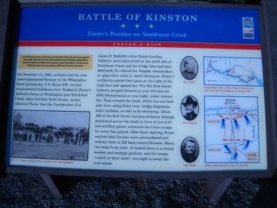
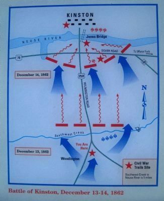
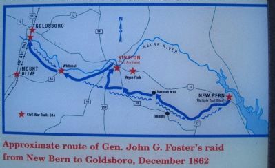
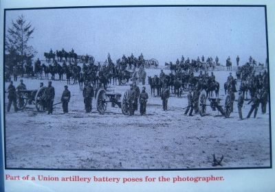
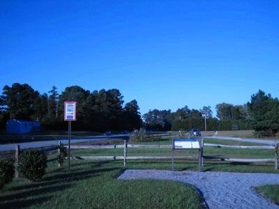
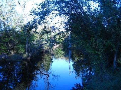
On December 13, 1862 as Foster and his command approached Kinston on the Wilmington Road (present-day U.S. Route 258), he first encountered Confederate Gen. Nathan G. Evansís defensive forces at Woodington near Southwest Creek. After 3rd New York Cavalray scouts informed Foster that the Confederates (Col. James D. Radcliffeís 61st North Carolina Infantry) were entrenched on the north side of Southwest Creek and the bridge here had been destroyed, he ordered his brigade commander to place their units in battle formation. Fosterís artillerists posted their guns on the right of the road here and opened fire. The 9th New Jersey Infantry pressed forward on your left and the 85th Pennsylvania on your right, under intense fire. They crossed the creek, which was not fordable here, using felled trees, bridge fragments, and a mill dam, as well as by swimming. About 400 of the 61st North Carolina Infantry, strongly positioned across the creek in front of you with two artillery pieces, contested the Union troops for every foot gained. After fierce fighting, Evans realized that his men were outnumbered and ordered them to fall back toward Kinston. About two miles from town, he halted them in a strong wooded and swampy position, and the troops “rested on their arms” overnight to await the next attack.
Erected by North Carolina Civil War Trails.
Topics and series. This historical marker is listed in these topic lists: War, US Civil • Waterways & Vessels. In addition, it is included in the North Carolina Civil War Trails series list. A significant historical month for this entry is December 1861.
Location. 35° 10.936′ N, 77° 37.445′ W. Marker is near Kinston, North Carolina, in Lenoir County. Marker is at the intersection of Richlands Road (U.S. 258) and Stroud's Corner Road on Richlands Road. Touch for map. Marker is in this post office area: Kinston NC 28504, United States of America. Touch for directions.
Other nearby markers. At least 8 other markers are within 5 miles of this marker, measured as the crow flies. Starr's Battery (approx. 4Ĺ miles away); The Union Artillery (approx. 4Ĺ miles away); Wessells' AdvanceóDecember 14, 1862 (approx. 4.6 miles away); The Center of the Confederate Line (approx. 4.6 miles away); The Action in the Swamp (approx. 4.6 miles away); The Confederate Defenses of Kinston (approx. 4.6 miles away); Caring for the Wounded (approx. 4.6 miles away); The Site of Harriet's Chapel (approx. 4.6 miles away). Touch for a list and map of all markers in Kinston.
More about this marker. This marker is Tour Stop 2 on the 1st Battle of Kinston Battlefield Trail. The Tour begins at Stop 1, the Blue and Gray Information Center on the Highway 70 near its intersection with Hwy 258.
Pictures of General Foster, General Wessells, and General Evans are in the center of the marker.
Related markers. Click here for a list of markers that are related to this marker. First Battle of Kinston by Markers
Credits. This page was last revised on June 16, 2016. It was originally submitted on October 26, 2009, by Kevin W. of Stafford, Virginia. This page has been viewed 1,811 times since then and 73 times this year. Photos: 1, 2, 3, 4, 5, 6. submitted on October 26, 2009, by Kevin W. of Stafford, Virginia. • Craig Swain was the editor who published this page.
