Gambles Hill in Richmond, Virginia — The American South (Mid-Atlantic)
Belle Isle
Captain John Smith’s Adventures on the James
— www.johnsmithtrail.org —
The Virginia Company of London instructed the first English colonists to choose a river for their settlement and to “let Captain Newport discover how far that river may be found navigable.” Following this charge, Newport and a group that included John Smith sailed upriver as far as modern Richmond in late May, 1607.
Richmond straddles the fall line between Virginia’s Coastal Plain and the Piedmont region, the limit of navigation for sailing vessels. “We were intercepted with great craggy stones in the midst of the river,” wrote Smith, “where the water falleth so rudely, and with such a violence, as not any boat can possibly passe.”
Although the rough water delayed the search for gold and a water route to the Orient, it exposed minerals like iron used in the colonists’ first industries. The English also recognized the river’s capacity for water-powered industry.
In the seven-mile stretch from Bosher’s Dam to the Mayo Bridge, the James River drops 105 feet in elevation. Today those rapids power some of the nation’s best urban whitewater paddling.
Capt. John Smith’s Trail
John Smith knew the James River by its Algonquian name: Powhatan, the same as the region’s paramount chief. Smith traveled the river many times between 1607 and 1609, trading with Virginia Indians to ensure survival at Jamestown. What he saw of Virginia’s verdant woodlands and pristine waters inspired him to explore the greater Chesapeake Bay, chronicling its natural wonders. Capt John Smith’s Trail on the James is a 40-site water and auto tour for modern explorers.
(sidebar)
The Capital of the Confederacy
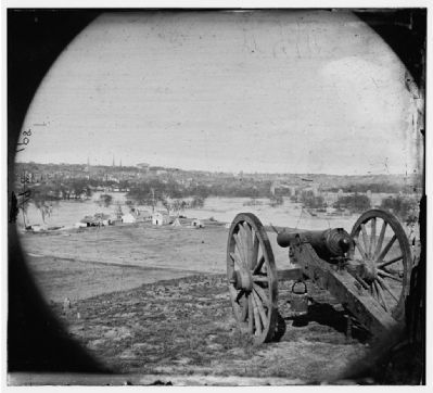
> Richmond was the capital of the Confederacy. It combined the special features of industry, finance, trade, and transportation which are visible all around you.
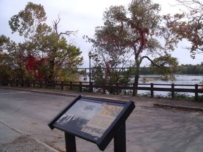
> Straight ahead is Belle Isle: site of an infamous Civil War prison.
> To your left are Brown’s Island and the Haxall Canal: site of a munitions factory, which blew up in 1863, killing 30 women workers.
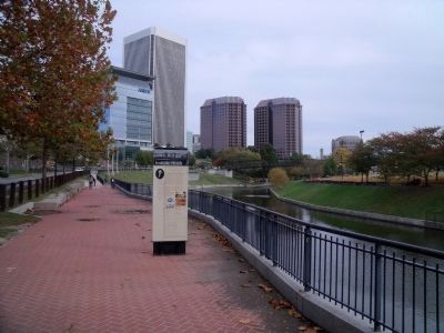
> On the horizon stands the steel and glass tower of the modern Federal Reserve Bank. Richmond was the banking and insurance center of the South based on the tobacco and slave trade.
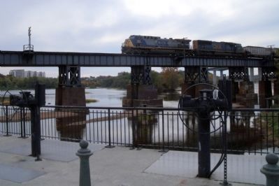
> Over the road is the current CSX railroad. Richmond had five railroads during the Civil War.
> Further to your left is Tredegar Ironworks, perhaps the largest munitions factory for the Confederacy during the Civil War.
> Behind you up the hill is the Kanawha Canal, the route around the rapids, and the freight highway to the Great Valley of Virginia.
Erected by
Captain John Smith’s Trail, James River Association, Virginia Department of Conservation and Recreation, Chesapeake Bay Gateways Network.
Topics. This historical marker is listed in these topic lists: Exploration • Native Americans • War, US Civil • Waterways & Vessels. A significant historical year for this entry is 1607.
Location. 37° 32.063′ N, 77° 26.903′ W. Marker is in Richmond, Virginia. It is in Gambles Hill. Marker is on Tredegar Street, 0.3 miles west of South 5th Street, on the right when traveling west. Touch for map. Marker is in this post office area: Richmond VA 23219, United States of America. Touch for directions.
Other nearby markers. At least 8 other markers are within walking distance of this marker. Welcome to Richmond’s Historic Riverfront (a few steps from this marker); Water Power (within shouting distance of this marker); Tredegar in the Twentieth Century / Then and Now (about 500 feet away, measured in a direct line); Horseshoe Shops (about 500 feet away); Robert E. Lee Bridge (about 500 feet away); Making Machines at Tredegar (about 500 feet away); Tredegar Rolling Mills (about 600 feet away); Industrial Recycling (about 600 feet away). Touch for a list and map of all markers in Richmond.
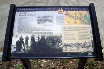
Regarding Belle Isle. On the upper center is a sketch of Native Americans “Digging for silver.” Drawing by Marc Castelli for the John Smith Four Hundred Project © 2006.
On the upper right is a map of Captain John Smith's Trail.
On the lower left is a depiction of English colonists coming ashore along the banks of the James River. The photo carries the caption “The New World” © MMV, New Line Productions, Inc. All rights reserved. Photo by Merie Wallace. Photo appears courtesy of New Line Productions, Inc.
The sidebar shows a sketch of a military encampment along the river. Image Courtesy of the Library of Virginia.
Also see . . .
1. Belle Isle Prison. Civil War Richmond (Submitted on October 28, 2009.)
2. Friends of the James River Park. (Submitted on October 27, 2009.)
3. The American Civil War Museum. (Submitted on October 27, 2009.)
4. James River and Kanawha Canal Historic District. National Register of Historic Places (Submitted on October 27, 2009.)
Credits. This page was last revised on February 1, 2023. It was originally submitted on October 27, 2009, by Bernard Fisher of Richmond, Virginia. This page has been viewed 1,575 times since then and 15 times this year. Photos: 1, 2, 3, 4, 5, 6. submitted on October 27, 2009, by Bernard Fisher of Richmond, Virginia. 7. submitted on November 1, 2009, by Bernard Fisher of Richmond, Virginia. 8. submitted on November 4, 2009, by Bernard Fisher of Richmond, Virginia. 9. submitted on October 27, 2009, by Bernard Fisher of Richmond, Virginia.
