Central Office District in Richmond, Virginia — The American South (Mid-Atlantic)
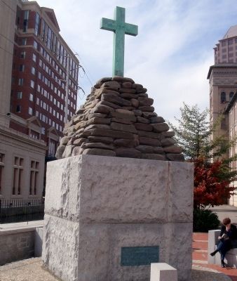
Christopher Newport Monument
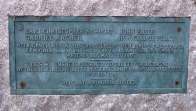
Capt. Christopher Newport
John Smith
Gabriel Archer
Hon. George Percy
With gentlemen, mariners, soldiers numbering twenty-one explored James River to the falls, and set up a cross
Whitsunday, May 24th 1607
This monument is presented to the City of Richmond by the Association for the Preservation of Virginia Antiquities
June 10th 1907
“Dei Gratia Virginia Condita”
Erected 1907 by Association for the Preservation of Virginia Antiquities.
Topics. This historical marker and monument is listed in these topic lists: Exploration • Settlements & Settlers. A significant historical date for this entry is May 24, 1924.
Location. 37° 32.034′ N, 77° 26.184′ W. Marker is in Richmond, Virginia. It is in the Central Office District. Marker can be reached from the intersection of South 12th Street and East Byrd Street. This monument is on the Richmond Riverfront Canal Walk. Touch for map. Marker is in this post office area: Richmond VA 23219, United States of America. Touch for directions.
Other nearby markers. At least 8 other markers are within walking distance of this marker. Christopher Newport Cross / Canal Walk (a few steps from this marker); Electric Trolley (within shouting distance of this marker); Tidewater Connection Locks (within shouting distance of this marker); James River & Kanawha Canal (within shouting distance of this marker); Ross' Mill Race (within shouting distance of this marker); Hydroelectric Plant (about 300 feet away, measured in a direct line); Gallego Mill Flume (about 300 feet away); The Center of Industry in 18th and 19th Century Richmond (about 400 feet away). Touch for a list and map of all markers in Richmond.
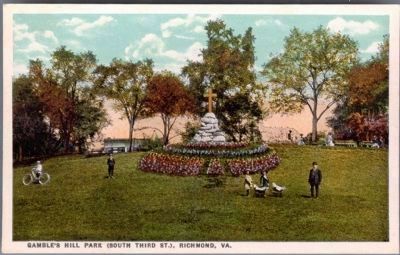
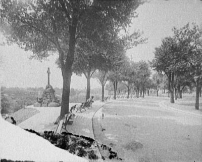
More about this monument. This monument was originally located on Gambles Hill. In 2000, the cross was moved to 12th Street.
Also see . . .
1. Richmond Riverfront Canal Walk. Venture Richmond (Submitted on October 29, 2009.)
2. James River and Kanawha Canal Historic District. National Register of Historic Places (Submitted on October 29, 2009.)
Credits. This page was last revised on February 1, 2023. It was originally submitted on October 29, 2009, by Bernard Fisher of Richmond, Virginia. This page has been viewed 1,675 times since then and 45 times this year. Photos: 1, 2, 3. submitted on October 29, 2009, by Bernard Fisher of Richmond, Virginia. 4. submitted on November 2, 2009, by Bernard Fisher of Richmond, Virginia.


