Central Office District in Richmond, Virginia — The American South (Mid-Atlantic)
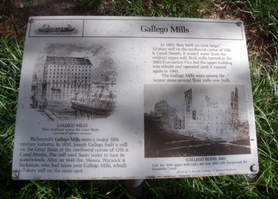
Gallego Mills
In 1860, they built an even larger 12-story mill on the southwest corner of 12th & Canal Streets. It reused water from the original upper mill. Both mills burned in the 1865 Evacuation Fire, but the upper building was rebuilt and operated until it burned in 1903.
(captions) Gallego Mills View across the Great Basin. (Courtesy of Valentine Museum)
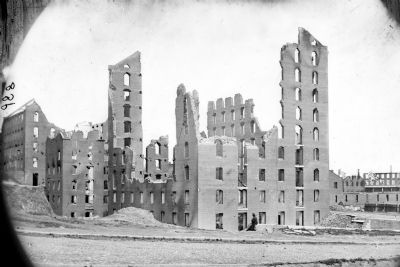
Gallego Ruins, 1865 Left, the 1848 upper mill; right, the new 1860 mill; foreground, the Kanawha Canal. (Photo by A. Russell, Courtesy of National Archives)
Topics. This historical marker is listed in these topic lists: Industry & Commerce • War, US Civil. A significant historical year for this entry is 1834.
Location. 37° 32.096′ N, 77° 26.125′ W. Marker is in Richmond, Virginia. It is in the Central Office District. Marker is at the intersection of South 12th Street and East Canal Street, on the right when traveling north on South 12th Street. Touch for map . Marker is in this post office area: Richmond VA 23219, United States of America. Touch for directions.
Other nearby markers. At least 8 other markers are within walking distance of this marker. Inside A Flour Mill (here, next to this marker); The Flour Trade (a few steps from this marker); Tidewater Connection Locks (about 300 feet away, measured in a direct line); James River & Kanawha Canal (about 300 feet away); 1201 East Cary Street (about 400 feet away); Gallego Mill Flume (about 400 feet away); Bowers Brothers Coffee and Tea Building (about 400 feet away); 1200 Block East Cary Street (about 500 feet away). Touch for a list and map of all markers in Richmond.
Credits. This page was last revised on February 1, 2023. It was originally submitted on October 30, 2009, by Bernard Fisher of Richmond, Virginia. This page has been viewed 2,040 times since then and 101 times this year. Photos: 1, 2. submitted on October 30, 2009, by Bernard Fisher of Richmond, Virginia. 3. submitted on November 1, 2009, by Bernard Fisher of Richmond, Virginia.


