Elliston in Montgomery County, Virginia — The American South (Mid-Atlantic)
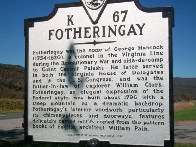
Fotheringay
Erected 1998 by Department of Historic Resources. (Marker Number K-67.)
Topics and series. This historical marker is listed in these topic lists: Architecture • War, US Revolutionary. In addition, it is included in the Virginia Department of Historic Resources (DHR) series list. A significant historical year for this entry is 1796.
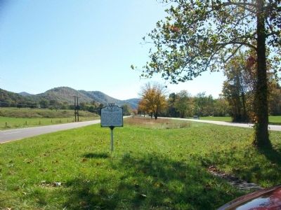
Location. Marker has been reported missing. It was located near 37° 11.434′ N, 80° 14.182′ W. Marker was in Elliston, Virginia, in Montgomery County. Marker was at the intersection of Roanoke Road (U.S. 11) and Graham Street, in the median on Roanoke Road. Located at a cross over. Touch for map. Marker was in this post office area: Elliston VA 24087, United States of America. Touch for directions.
Other nearby markers. At least 8 other markers are within 9 miles of this location, measured as the crow flies. Fort Vause (approx. 2 miles away); American Revolution on the Frontier (approx. 2.9 miles away); Bow String Arch Truss (approx. 3.4 miles away); Montgomery White Sulphur Springs (approx. 3.4 miles away); The “Bowstring” Truss Bridge (approx. 3.4 miles away); Montgomery County / Roanoke County (approx. 3.8 miles away); Floyd County / Roanoke County (approx. 7.6 miles away); Fort Lewis (approx. 8.8 miles away).
Also see . . . George Hancock from the Biographical Directory of the United States Congress. (Submitted on November 6, 2009, by Bill Pfingsten of Bel Air, Maryland.)
Credits. This page was last revised on December 25, 2019. It was originally submitted on October 31, 2009, by Kathy Walker of Stafford, Virginia. This page has been viewed 1,506 times since then and 59 times this year. Photos: 1, 2. submitted on October 31, 2009, by Kathy Walker of Stafford, Virginia. • Bill Pfingsten was the editor who published this page.

