Narrowsburg in Sullivan County, New York — The American Northeast (Mid-Atlantic)
Fort Delaware / Narrowsburg’s History
Upper Delaware Scenic Byway
< Fort Delaware Side: >
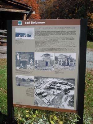
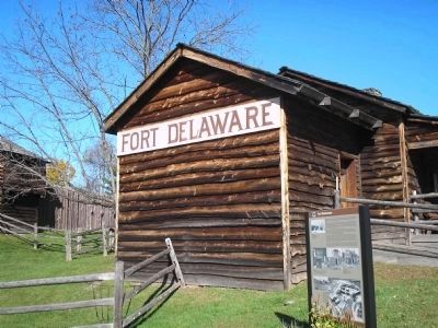
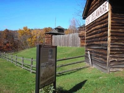
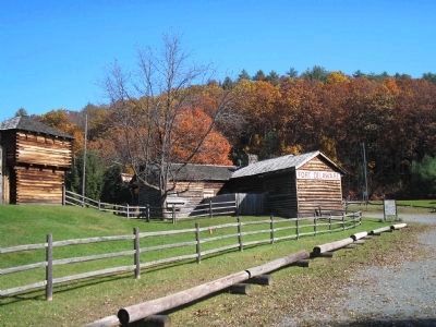
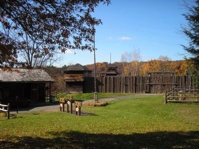
The present day Fort, a replica of the frontier “lower fort” of the Cushetunk settlement of 1755-1785, was originally located six miles up river near Milanville, Pennsylvania. Another fort was situated further up river in the Cushetunk settlement.
Fort Delaware is “dedicated to the Connecticut Yankees, who settled in the Delaware Valley.” The first settlers, farmers of English descent who came primarily from eastern Connecticut, formed “The Delaware Company” and purchased land from the Lenape Indians, signing the first deed in 1754. The Lenape referred to this ten-mile long strip along both sides of the Delaware River as “Cushetunk,” or something that sounds similar, which means either “a place of red stone hills” or “low lands washed over by water.”
By 1760 there were thirty cabins, a gristmill and sawmill. Each spring saw the arrival of more settlers who faced hardships probably never conceived of in Connecticut: a remote wilderness, rough winters, the possibility of Indian attacks and the concern that farming the land might not sustain them. In 1761 a stockade was erected around three homes to serve as protection for the entire settlement against attack.
The settlers came into the area during the French and Indian War (1755-1763). Conflicts between the settlers and Native Americans eventually led to the near eradication of the Native American presence in Pennsylvania. The only known attack on Fort Delaware itself occurred in April 1763, when a Lenape war party sought revenge for the murder of their Chief, Teddyescung. In fact, this murder was probably committed by Iroquois rivals or members of the Susquehanna. One man, Ezra Witter, and the women and children residing within the Fort repelled the attack through a convincing display of force, which took one Lenape life.
The timber business was introduced into the community in 1794. It became a very successful operation resulting in a steady flow of cash which increased the development of Cushetunk. In the years between the French and Indian Wars and the American Revolution, people abandoned the fort as the threat of Native American attack decreased and built what they called “fair houses”.
< Narrowsburg’s History Side: >
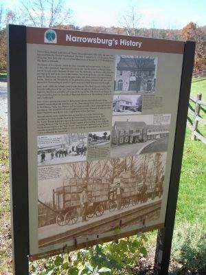
Narrowsburg, located in the town of Tusten, was established in 1853, when the town was separated from the Town of Lumberland. The town is named for Lt. Col. Benjamin Tusten of Goshen, New York, who was one of the fallen heroes of the July 22, 1779 Revolutionary War Battle of Minisink.
The history of the region is tied to the river, commerce and transportation.
In the mid-1750’s, when settlement began here, this community was first known as Homan’s Eddy, named for early settler Benjamin Homan. Later the community was known as Big Eddy for the large quiet pool in the river at this location. Narrowsburg became a favorite stopping point for lumbermen who steered the great timber rafts down the river to the large markets of Easton, Trenton, and Philadelphia. At the peak of the rafting, a thousand rafts men could descend on Narrowsburg in search of a good meal and a clean hotel room for the night.
Later in the 1800’s the railroad carried people from the New York City area seeking relief from the stifling heat of the city. From the 1930’s through the 1950’s, thousands of New York City Boy Scouts arrived by rail to attend the nearby Ten Mile River Scout Camps. At the present time, there are two railroad-dependent businesses in Narrowsburg: a feed mill and a lumberyard.
Now visitors, arriving year-round in their personal vehicles, still seek the same things: beautiful surroundings and relief from city life. Narrowsburg’s lively streetscape is anchored by the Delaware Valley Arts Alliance, and businesses oriented to both visitors and the local community. The annual RiverFest and EagleFest events draw thousands of visitors to Main Street. Narrowsburg is known as the Eagle Capital of New York State.
Arts and entertainment events have been an important part of the Narrowsburg community for many decades. Built by the Narrowsburg Fire Department in 1925, the Tusten Theatre helped pay expenses by presenting silent films, dances and small traveling shows in “The Community Theater” portion of the building. In the 1930’s the theatre became known as the “Park Theater” and remained a permanent part of Tusten’s entertainment until the late 1980’s. In 1873, the building was purchased by the Town of Tusten and became the Town Hall.
Topics. This historical marker is listed in these topic lists: Colonial Era • Native Americans • Settlements & Settlers • War, French and Indian • War, US Revolutionary. A significant historical month for this entry is April 1763.
Location. 41° 36.846′ N, 75° 3.404′ W. Marker is in Narrowsburg, New York, in Sullivan County. Marker is on New York State Route 97, on the left when traveling west. Touch for map. Marker is in this post office area: Narrowsburg NY 12764, United States of America. Touch for directions.
Other nearby markers. At least 8 other markers are within walking distance of this marker. Fort Delaware (a few steps from this marker); Fort Delaware Museum (a few steps from this marker); a different marker also named Fort Delaware (within shouting distance of this marker); Thomas Dunn (approx. 0.3 miles away); The Bridges over the Delaware (approx. 0.4 miles away); War Memorial (approx. 0.4 miles away); Dexter Manufacturing (approx. 0.4 miles away); Tusten Town Hall (approx. 0.4 miles away). Touch for a list and map of all markers in Narrowsburg.
More about this marker. Several photographs of Fort Delaware appear on the “Fort Delaware” side of the marker. Two along the marker’s bottom have a caption of “Fort Delaware Above: Complete with flag, block houses and stockade walls, sometimes called a palisade, Fort Delaware reminds us of the settlers who lived in the Delaware River Valley. Right: Fort Delaware opened to the public while under construction in the late 1950’s. Generations young and old from the community present history demonstrations – dipping candles, blacksmithing, spinning, weaving, gardening, firing the cannon and tending the animals.” The top left of the marker features a Snowy Day photo, with the caption “Winter puts a fresh blanket of snow on the construction progress at Fort Delaware. Winter was one of the hard times settlers faced in their move to the Delaware River Valley.” Also present are photos of the local community at Fort Delaware. One has a caption of “Visionary Fort Delaware today is the culmination of the determined efforts of James Burbank (above, with his daughter), a community activist, historian, artist and educator, along with the members of the Fort Delaware Corporation. Wishing to rescue the fading remains of the original Fort Delaware, a new fort was built outside Narrowsburg. In 1970, the fort was acquired by Sullivan County.” The photos next to this have a caption of “Rustic Appearance Members of the community (above) exerted great efforts to recreate the Fort’s rustic appearance. A partially completed blockhouse (left) anchors one corner of the stockade fence.
The marker’s “Narrowsburg’s History” side also contains a series of photographs. Photos include: “The Tusten Theatre The Delaware Valley Arts Alliance presents live concerts, operas, theatre, films and media. The Tusten Theatre was renovated in 1989-90 through a HUD grant obtained by U.S. Representative Benjamin Gilman and in partnership with Delaware Valley Arts Alliance, the Town of Tusten, and the Sullivan County Planning Department.”, “Summer Visitors In the summertime, the many boarding houses in the region filled with families enjoying the surrounding countryside’s quiet beauty and cool air. In the fall, hunters returned.” , “Railroad Town The coming of the Erie Railroad in 1848 brought more track-side ‘eating houses’ and hotels. Many of the German and Irish immigrant laborers who helped build the railroad stayed in the area and their descendants still populate the region.”, “Ice Harvest Ice was harvested every winter from the Big Eddy. Notice the covered bridge crossing the river at the narrow point.”, and “Products to Market As the lumber and related tanning bark businesses faded, agriculture remained strong and bluestone quarrying grew in importance. The railroad carried these products to market. Here, eggs are readied for the trip to New York City.”
Also see . . . Fort Delaware Museum of Colonial History. Sullivan County website entry (Submitted on October 31, 2009, by Bill Coughlin of Woodland Park, New Jersey.)
Credits. This page was last revised on December 23, 2021. It was originally submitted on October 31, 2009, by Bill Coughlin of Woodland Park, New Jersey. This page has been viewed 3,100 times since then and 33 times this year. Photos: 1, 2, 3, 4, 5, 6. submitted on October 31, 2009, by Bill Coughlin of Woodland Park, New Jersey.
