Near Reask in County Kerry, Munster, Ireland — Irish South-West ((Éire) North Atlantic Ocean)
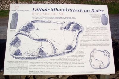
Reask Monastic Site / Láthair Mhainistreach an Riaisc
Reask - from An Riasc (the marsh).
This important early monastery was probably founded in the 6th century.
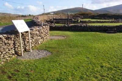
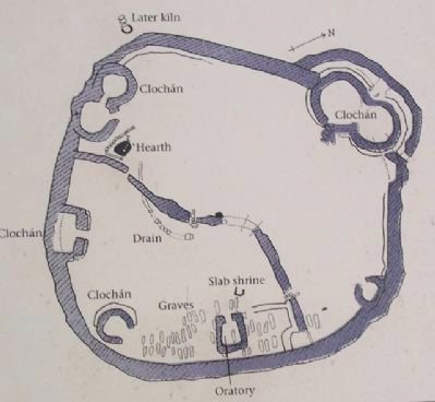
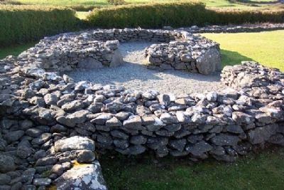
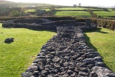
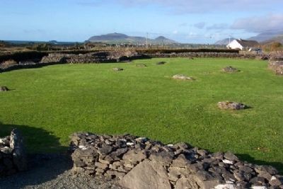
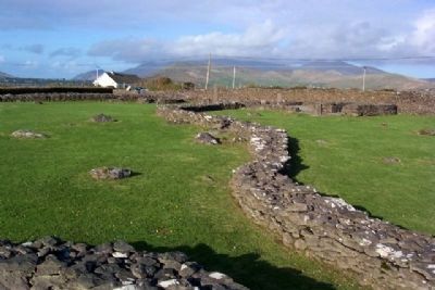
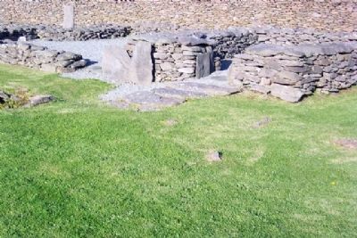
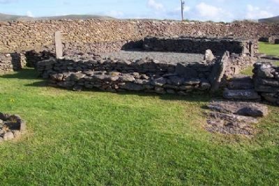
Little is known of the history of the site. The enclosing wall is roughly circular and its interior is divided by a curving wall into two parts. In the eastern part is the oratory (a small church) which was made - like all the other buildings on the site - with dry-stone walls with a corbelled roof; no mortar was used to hold the walls together.
Besides and under the oratory is an earlier cemetery of forty-two graves arranged in two rows; in front is a small sunken area of paving which may have been the base of a shrine for relics. The area around the oratory was used as a ceallúnach - a children's burial ground - after the monastery was abandoned.
Large circular clocháns (beehive shaped stone buildings which were the homes of the monks), arranged in pairs in two cases, and one small rectangular clochán are incorporated into the enclosing wall of the monastery.
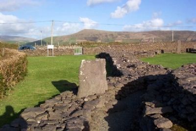
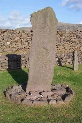
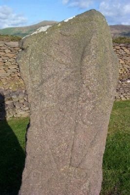
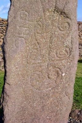
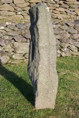
At least ten cross-inscribed slabs are known from the site, including the famous “Reask Stone” which is decorated with spiral designs and carved with the letters DNE (which stand for Domine; Latin for O Lord.
—————————
Is beag atá ar eolas faoi stair na láithreach seo. Ciorcal garbh atá sa bhalla teorann agus tá an spás taobh istigh roinnte i ndá leath ag balla cuartha. Sa chuid thoir de tá an t-aireagal (eaglais bheag) a tógadh, fearacht foirgneamh eile ar an láithreán, le ballaí fuara agus díon coirbéalta; níor úsáideadh aon mhoirtéal san obair.
In aice leis an aireagal agus faoi, tá seanreilig a bhfuil 42 uaigh leagtha amach i ndá shraith inti; tá limistéar beag íseal pábháilte chun tosaigh agus d'fhéadfadh sé go raibh scrín taisí ann tráth. Nuair a tréigeadh an mhainistir, úsáideadh an limistéar timpeall ar an aireagal mar cheallúnach - áit adhlactha leanaí.
Tá clocháin mhóra (foirgnimh cloiche le cruth coirceogach orthu a maireadh na manaigh iontu) leagtha amach i bpéirí i ndá chás, agus tá ceann beag cearnógach mar chuid den bhalla teorann.
Tá ar a laghad deich gcinn de leacanna croise a tháinig as an láthair seo ar eolas. Orthu sin tá Cloch cáiliúil an Riaisc atá maisithe le patrún bíseach agus a bhfuil na litreacha DNE gearrtha uirthi (seasann DNE do Domine; an Laidin ar A Thiarna).
Erected by Dúchas The Heritage Service.
Topics. This historical marker is listed in these topic lists: Cemeteries & Burial Sites • Churches & Religion • Man-Made Features • Notable Places • Settlements & Settlers.
Location. 52° 10.063′ N, 10° 23.25′ W. Marker is near Reask, Munster, in County Kerry. Marker is along a narrow lane about 1000 feet SW of R559, and about 0.8 miles south of the coastal village of Ballinrannig, on the western Dingle Peninsula. Touch for map. Touch for directions.
Other nearby markers. At least 4 other markers are within 8 kilometers of this marker, measured as the crow flies. Gallarus Oratory / Séipéilín Ghallarais (approx. 2.6 kilometers away); Kilmalkedar Church / Cill Mhaoilchéadair (approx. 3.9 kilometers away); The Blaskets (approx. 7.2 kilometers away); Dunbeg Promontory Fort / An Dún Beag (approx. 7.3 kilometers away).
Also see . . . Reask Monastic Site. (Submitted on November 8, 2009.)
April 10, 2009
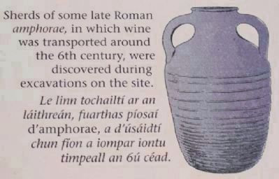
4. Reask Monastic Site Roman Vessel Drawing on Marker
Sherds of some late Roman amphorae, in which wine was transported around the 6th century, were discovered during excavations on the site.
Le linn tochailtí ar an láithreán, fuarthas píosaí d'amphorae, a d'úsáidtí chun fíon a iompar iontu timpeall an 6ú céad.
Le linn tochailtí ar an láithreán, fuarthas píosaí d'amphorae, a d'úsáidtí chun fíon a iompar iontu timpeall an 6ú céad.
Credits. This page was last revised on July 24, 2018. It was originally submitted on November 6, 2009, by William Fischer, Jr. of Scranton, Pennsylvania. This page has been viewed 2,020 times since then and 12 times this year. Photos: 1, 2, 3, 4, 5, 6, 7, 8, 9, 10, 11, 12, 13, 14, 15. submitted on November 8, 2009.
