Coltons Point in St. Mary's County, Maryland — The American Northeast (Mid-Atlantic)
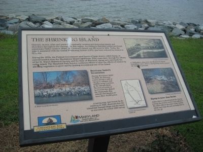
The Shrinking Island
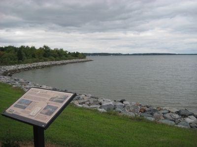
During the 1920s, the Federal Government used layers of large stones, called riprap, to control erosion near the Blackistone Island Lighthouse. Fifty years later, through the efforts of the St. Mary's Historical Society and the State of Maryland, riprap now surrounds the entire island. The Maryland Park Service continues efforts to slow the effects of erosion by allowing vegetation to grow and by limiting recreational use of the island.
Hurricane Isabel's Devastation
During Hurricane Isabel in 2003, the Potomac waters forced a wall of riprap to collapse and washed away a portion of the island's bank. The fury of scores of hurricanes has shaped the Chesapeake Bay islands and beaches for more than 10,000 years.
[map image] A survey map, last revised by the military in 1920, illustrates how the island had changed shape and decrease in size since the 1883 survey.
[1920s photo] A 1920s photo, taken from the Blackistone Island Lighthouse tower, shows a riprap being used to protect the lighthouse grounds.
[photo] Riprap is more than rocks
A filter fabric is placed behind the riprap, making the erosion control more effective. The fabric allows the water to flow off the island and traps the soil normally lost in the run off.
Erected by Chesapeake Bay Gateways Network, Maryland Department of Natural Resources.
Topics and series. This historical marker is listed in these topic lists: Churches & Religion • Colonial Era • Environment. In addition, it is included in the Lighthouses series list. A significant historical year for this entry is 1634.
Location. Marker has been permanently removed. It was located near 38° 12.548′ N, 76° 44.55′ W. Marker was in Coltons Point, Maryland, in St. Mary's County. Marker could be reached from Point Breeze Road, 0.2 miles east of Colton Point Road (Maryland Route 242). Marker is on St. Clements Island which is only accessibly by boat. A ferry operates on weekends from the St. Clement's Island Museum on Point Breeze Road. Touch for map. Marker was in this post office area: Coltons Point MD 20626, United States of America.
We have been informed that this sign or monument is no longer there and will not be replaced. This page is an archival view of what was.
Other nearby markers. At least 8 other markers are within walking distance of this location. St. Clement's Hundred (about 300 feet away, measured in a direct line); Ancestral Garden (about 600 feet away); St. Clement's Island (about 600 feet away); Freedom to Worship (about 600 feet away); Trade Expands (about 700 feet away); Blackistone Lighthouse (about 700 feet away); a different marker also named Blackistone Lighthouse (about 800 feet away); a different marker also named Blackistone Lighthouse (approx. 0.2 miles away). Touch for a list and map of all markers in Coltons Point.
Credits. This page was last revised on August 27, 2022. It was originally submitted on November 7, 2009, by F. Robby of Baltimore, Maryland. This page has been viewed 983 times since then and 6 times this year. Photos: 1, 2. submitted on November 7, 2009, by F. Robby of Baltimore, Maryland.

