Oneonta in Blount County, Alabama — The American South (East South Central)
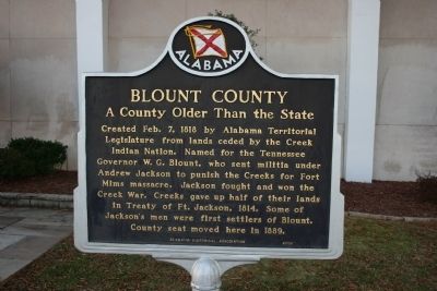
Blount County
A County Older Than the State
Erected 2006 by Alabama Historical Association.
Topics and series. This historical marker is listed in these topic lists: Government & Politics • Native Americans • Settlements & Settlers • Wars, US Indian. In addition, it is included in the Alabama Historical Association, and the Former U.S. Presidents: #07 Andrew Jackson series lists. A significant historical date for this entry is February 7, 1818.
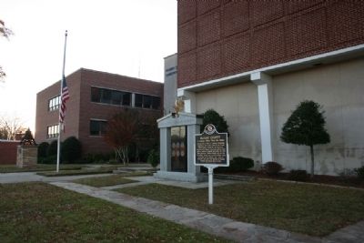
Location. 33° 56.832′ N, 86° 28.458′ W. Marker is in Oneonta, Alabama, in Blount County. Marker is at the intersection of Second Avenue East (US Highway 231) and 4th Street North, on the right when traveling west on Second Avenue East (US Highway 231). Touch for map. Marker is in this post office area: Oneonta AL 35121, United States of America. Touch for directions.
Other nearby markers. At least 8 other markers are within 9 miles of this marker, measured as the crow flies. Welcome to Oneonta (approx. 0.2 miles away); Historic Oneonta L & N Railroad Depot (approx. 0.2 miles away); Champion Mines (approx. 1.1 miles away); Antioch Cemetery (approx. 4.3 miles away); Bailey School (approx. 7.9 miles away); Holly Springs School (approx. 8.4 miles away); Exploit of Murphree Sisters (approx. 8.4 miles away); Battle Royal (approx. 8.4 miles away). Touch for a list and map of all markers in Oneonta.
Also see . . . Blount County. Encyclopedia of Alabama entry. (Submitted on November 10, 2009, by Timothy Carr of Birmingham, Alabama.)
Credits. This page was last revised on September 17, 2020. It was originally submitted on November 10, 2009, by Timothy Carr of Birmingham, Alabama. This page has been viewed 2,736 times since then and 82 times this year. Photos: 1, 2, 3. submitted on November 10, 2009, by Timothy Carr of Birmingham, Alabama. • Bill Pfingsten was the editor who published this page.


