Front Royal in Warren County, Virginia — The American South (Mid-Atlantic)
Front Royal
Crossroads of War

Photographed By Devry Becker Jones (CC0), October 23, 2020
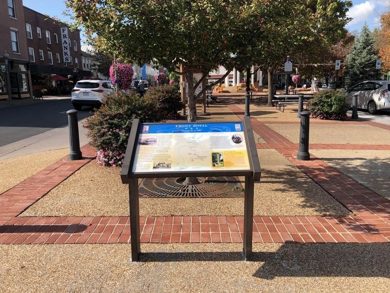
1. Front Royal Marker
Unfortunately, the marker has weathered although it remains legible.
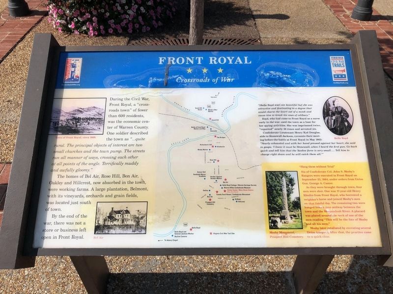
During the Civil War, Front Royal, a “cross-roads town” of fewer than 600 residents, was the economic center of Warren County. One soldier described the town as “...quite rural. The principal objects of interest are two small churches and the town pump. The streets run all manner of ways, crossing each other at all points of the angle. Terrifically muddy and awfully gloomy.”
The homes of Bel Air, Rose Hill, Bon Air, Oakley and Hillcrest, now absorbed in the town, were working farms. A large plantation, Belmont, with its vinyards, orchards and grain fields, was located just south of town.
By the end of the war, there was not a store or business open in Front Royal.
(Inscription in upper right of marker) “(Belle Boyd was) not beautiful but she was attractive and fascinating to a degree that would charm the heart out of a monk and cause him to break his vows of celibacy.”
Boyd, who had come to Front Royal early in the war, used the town as a base for her spying activities. She was imprisoned twice, “reported” nearly 30 times and arrested six.
Confederate Lieutenant Henry Kyd Douglas, aide to Stonewall Jackson, recounts their meeting before the battle at Front Royal in May, 1862. “Nearly exhausted and with her hand pressed against her heart, she said in gasps ‘I knew it must be Stonewall when I heard the first gun. Go back quick and tell him that the Yankee force is very small ... Tell him to charge right down and he will catch them all.’ ”
(Inscription in lower right corner of marker) “Hang them without trial.” Six of Confederate Col. John S. Mosby’s Rangers were executed on September 23, 1864 under orders from Union Gen. George A. Custer.
As they were brought through the town, four men were shot. One was 17-year-old Henry Rhodes from Front Royal, who borrowed a neighbors horse and joined Mosby’s men on that fateful day. The remaining two were hanged from a tree midway between the town and the Shenandoah River. A placard was placed around the neck of one of the men reading “This will be the fate of Mosby and all his men.”
Mosby later retaliated by executing several Union troopers. After that, the practice came to a quick close.
Erected by Civil War Trails.
Topics and series. This historical marker is listed in these topic lists: Settlements & Settlers • War, US Civil. In addition, it is included in the Battlefield Trails - Civil War, and the Virginia Civil War Trails series lists. A significant historical month for this entry is May 1862.
Location. 38°
55.052′ N, 78° 11.369′ W. Marker is in Front Royal, Virginia, in Warren County. Marker is on East Main Street near Blue Ridge Avenue. Touch for map. Marker is in this post office area: Front Royal VA 22630, United States of America. Touch for directions.
Other nearby markers. At least 8 other markers are within walking distance of this marker. Site of Lane's Tavern (within shouting distance of this marker); Williams Chapel (about 700 feet away, measured in a direct line); Erin Dinner Bell (approx. 0.2 miles away); The Great Seal of the Confederacy (approx. 0.2 miles away); Bel Air (approx. 0.2 miles away); The Courthouse (approx. 0.2 miles away); Capture of Front Royal (approx. 0.2 miles away); Warren County World War I & II Memorial (approx. 0.2 miles away). Touch for a list and map of all markers in Front Royal.
Regarding Front Royal. This marker is the "trail head" for a driving tour of the Front Royal Battlefield by way of Civil War Trails markers. See the Related Markers section or the Battle of Front Royal Virtual Tour by Marker link below to see the related markers in tour sequence.
Related markers. Click here for a list of markers that are related to this marker. This series of markers are the stops on the Battle of Front Royal Driving Tour.
Also see . . . Battle of Front Royal Virtual Tour by Markers. (Submitted on November 18, 2007, by Craig Swain of Leesburg, Virginia.)

Photographed By Devry Becker Jones (CC0), October 23, 2020
3. Front Royal Marker at the Visitor Center
Credits. This page was last revised on October 25, 2020. It was originally submitted on September 11, 2007, by Tom Fuchs of Greenbelt, Maryland. This page has been viewed 2,348 times since then and 44 times this year. Photos: 1. submitted on October 25, 2020, by Devry Becker Jones of Washington, District of Columbia. 2. submitted on September 11, 2007, by Tom Fuchs of Greenbelt, Maryland. 3. submitted on October 25, 2020, by Devry Becker Jones of Washington, District of Columbia. • J. J. Prats was the editor who published this page.
