Gambles Hill in Richmond, Virginia — The American South (Mid-Atlantic)
Belle Isle and Old Dominion Iron and Nail Works
Inscription.
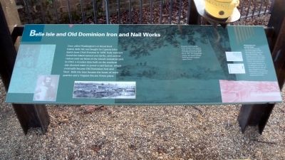
Once called Washington’s or Broad Rock Island, Belle Isle was bought by Captain John Smith from Chief Powatan in 1608. Early travelers found the island natural and idyllic and current visitors only see hints of the island’s industrial past. In 1815, a wooden dam built on the southern side diverted water to power a nail factory, which eventually became Old Dominion Iron and Steel. Belle Isle later became the home of stone quarries and a Virginia Electric Power plant.
Old Dominion Iron and Nail Works
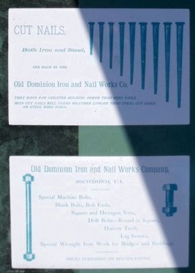
Old Dominion Iron and Nail Works began in 1832. This large factory employed many Richmonders. The company manufactured iron bars, horseshoes, nails, spikes, staybolt bars for steam locomotives, and plates for the C.S.S Virginia and other vessels during the Civil War. As steel replaced iron, the company changed its name to Old Dominion Iron and Steel Corporation and began producing steel products.
Topics. This historical marker is listed in these topic lists: Industry & Commerce • War, US Civil. A significant historical year for this entry is 1608.
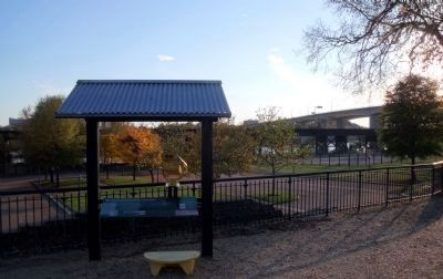
Location. 37° 32.127′ N, 77° 26.785′ W. Marker is in Richmond, Virginia. It is in Gambles Hill. Marker can be reached from Tredegar Street, 0.1 miles west of South 5th Street. This marker is located outside the Civil War Visitor Center at Tredegar Iron Works. Touch for map. Marker is at or near this postal address: 470 Tredegar Street, Richmond VA 23219, United States of America. Touch for directions.
Other nearby markers. At least 8 other markers are within walking distance of this marker. Tredegar in 1951 (here, next to this marker); Belle Isle Prison (a few steps from this marker); The Bulldozer Press (a few steps from this marker); President Lincoln Visits Richmond (within shouting distance of this marker); Francis Turbine (within shouting distance of this marker); Adapting Power (within shouting distance of this marker); Early Industrial Patterns (within shouting distance of this marker); Tredegar Rolling Mills (within shouting distance of this marker). Touch for a list and map of all markers in Richmond.
More about this marker. On the upper left are images of Captain John Smith and Chief Powhatan. On the lower left is a photograph of Old Dominion Nails & Iron.
On the right is a watercolor of Belle Isle with the caption, "Benjamin Henry Latrobe, noted architect and engineer, made this watercolor looking toward Richmond from Belle Isle in 1796. The foreground conveys the island’s natural landscape before industry came in 1815."
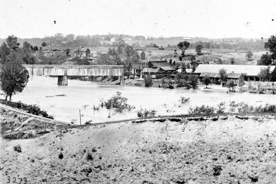
On the lower right is a drawing of the covered railroad bridge to Belle Isle.
Also see . . .
1. Old Dominion Iron and Steel Corporation. Southern Railwayfan (Submitted on November 11, 2009.)
2. Belle Isle Prison. Civil War Richmond (Submitted on November 11, 2009.)
Credits. This page was last revised on February 1, 2023. It was originally submitted on November 11, 2009, by Bernard Fisher of Richmond, Virginia. This page has been viewed 3,986 times since then and 156 times this year. Photos: 1, 2, 3, 4, 5. submitted on November 11, 2009, by Bernard Fisher of Richmond, Virginia.


