Near Williamsburg in James City County, Virginia — The American South (Mid-Atlantic)
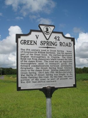
Green Spring Road
Erected 2002 by Department of Historic Resources. (Marker Number V-42.)
Topics and series. This historical marker is listed in these topic lists: Roads & Vehicles • War, US Revolutionary. In addition, it is included in the Virginia Department of Historic Resources (DHR) series list. A significant historical date for this entry is July 6, 1781.
Location. 37° 14.105′ N, 76° 47.108′ W. Marker is near Williamsburg, Virginia, in James City County. Marker is on Greensprings Road (County Route 614) north of 4h Club Road, on the right when traveling north. Touch for map. Marker is in this post office area: Williamsburg VA 23185, United States of America. Touch for directions.
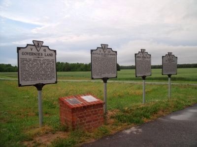
Other nearby markers. At least 8 other markers are within walking distance of this marker. Governor’s Land (here, next to this marker); Church on the Main (here, next to this marker); Battle Of Green Spring (here, next to this marker); Battle of Green Spring (within shouting distance of this marker); Samuel H. Yonge, Civil Engineer (1843-1935) (approx. 0.4 miles away); Pocahontas (approx. 0.4 miles away); Jamestown Road (approx. half a mile away); First Germans at Jamestown (approx. half a mile away). Touch for a list and map of all markers in Williamsburg.
More about this marker. Also sits with 3 other markers V41,V39,V46
Credits. This page was last revised on June 16, 2016. It was originally submitted on September 11, 2007, by Laura Troy of Burke, Virginia. This page has been viewed 1,490 times since then and 24 times this year. Photos: 1. submitted on September 11, 2007, by Laura Troy of Burke, Virginia. 2. submitted on May 12, 2010, by Bernard Fisher of Richmond, Virginia. • J. J. Prats was the editor who published this page.

