Near Sharon in York County, South Carolina — The American South (South Atlantic)
Dickey - Sherer House
[Front]:
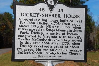
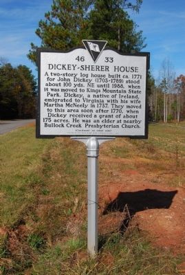
A two-story log house built ca. 1771 for John Dickey (1703-1789) stood about 100 yds. NE until 1988, when it was moved to Kings Mountain State Park. Dickey, a native of Ireland, emigrated to Virginia with his wife Martha McNeely Dickey in 1737. They moved to this area after 1770, when Dickey received a grant of about 175 acres. He was an elder at nearby Bullock Creek Presbyterian Church.
[Reverse]:
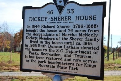
In 1844 Richard Sherer (1796-1888) bought the house and 76 acres from the descendants of Martha McNeely Dickey. Members of the Sherer family lived in the house until ca. 1918. In 1988 Ruth Duncan Latham donated the house to the S.C. Department of Parks, Recreation, and Tourism. It has been restored and now serves as the park headquarters for Kings Mountain State Park.
Erected 2004 by Broad River Basin Historical Society. (Marker Number 46-33.)
Topics. This historical marker is listed in these topic lists: Notable Buildings • Settlements & Settlers. A significant historical year for this entry is 1771.
Location. 34° 54.744′ N, 81° 22.176′ W. Marker is near Sharon, South Carolina, in York County. Marker is at the intersection of Wilson Chapel Road and Hoodtown Road, on the right when traveling north on Wilson Chapel Road. Touch for map. Marker is in this post office area: Sharon SC 29742, United States of America. Touch for directions.
Other nearby markers. At least 10 other markers are within 6 miles of this marker, measured as the crow flies. Blairsville Schools (approx. 0.8 miles away); First National Bank of Sharon (approx. 3.2 miles away); Town of Sharon / Sharon (approx. 3.3 miles away); Town of Sharon Stone Marker (approx. 3.3 miles away); Lacey's Fort (approx. 4 miles away); Bullock Creek Revolutionary War Monument (approx. 4.4 miles away); Bullock Creek Presbyterian Church (approx. 4˝ miles away); Hickory Grove Schools (approx. 5.2 miles away); Hickory Grove (approx. 5.2 miles away); Unity Academy (approx. 6 miles away). Touch for a list and map of all markers in Sharon.
Credits. This page was last revised on November 27, 2020. It was originally submitted on November 15, 2009, by Michael Sean Nix of Spartanburg, South Carolina. This page has been viewed 2,517 times since then and 85 times this year. Photos: 1, 2, 3. submitted on November 15, 2009, by Michael Sean Nix of Spartanburg, South Carolina. • Kevin W. was the editor who published this page.
Editor’s want-list for this marker. Picture of the two-story log house mentioned on the marker, now at Kings Mountain State Park. • Can you help?


