Monticello in Sullivan County, New York — The American Northeast (Mid-Atlantic)
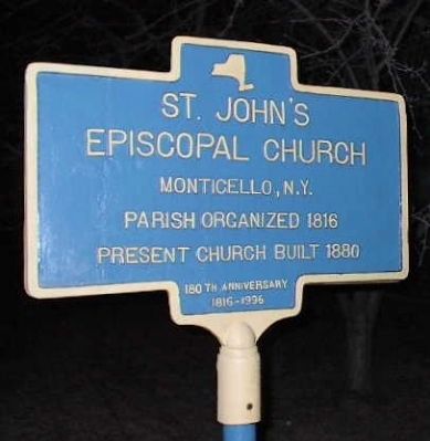
St John's Episcopal Church
Parish organized 1816
Present Church built 1880
180th Anniversay 1816-1996
Erected 1996.
Topics. This historical marker is listed in this topic list: Churches & Religion. A significant historical year for this entry is 1816.
Location. 41° 39.207′ N, 74° 41.13′ W. Marker is in Monticello, New York, in Sullivan County. Marker is on Saint John Street, 0.1 miles south of Broadway (New York State Route 42), on the left when traveling south. Touch for map. Marker is at or near this postal address: 13 Saint John St, Monticello NY 12701, United States of America. Touch for directions.
Other nearby markers. At least 8 other markers are within 4 miles of this marker, measured as the crow flies. Site of First House in Monticello (about 400 feet away, measured in a direct line); Presbyterian Church (about 500 feet away); Methodist Church (approx. 0.2 miles away); Borscht Belt - Monticello (approx. ¼ mile away); Monticello Depot (approx. 0.3 miles away); Site of Toll House (approx. 0.9 miles away); Camp Holley (approx. 1.6 miles away); One-Room School (approx. 3.1 miles away). Touch for a list and map of all markers in Monticello.
Also see . . . The history of St. John's Episcopal church, Monticello, New York, for one hundred years, 1816-1916. Compiled to commemorate its centenary (1916) (Submitted on December 20, 2009, by Tom Rue of Monticello, New York.)

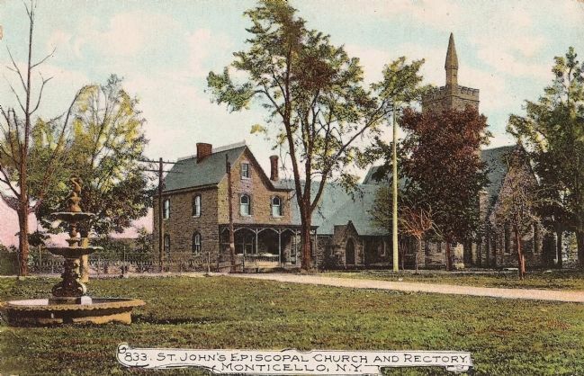
circa 1912
2. St. John's Episcopal Church and Rectory
The photographer of this picture was standing on the vacant lot where the Rockwell Hotel once stood, at the corner of Main and Mill streets (now Broadway and St. John Street) until it was destroyed by the fire of August 10, 1909. A few hundred yards to the left of the church is the John P. Jones house (see historical marker).
Credits. This page was last revised on June 16, 2016. It was originally submitted on November 16, 2009, by Clifton Patrick of Chester, NY, United States. This page has been viewed 1,001 times since then and 15 times this year. Photos: 1. submitted on November 16, 2009, by Clifton Patrick of Chester, NY, United States. 2. submitted on December 20, 2009, by Tom Rue of Monticello, New York. 3. submitted on December 21, 2009, by Tom Rue of Monticello, New York. 4. submitted on November 16, 2009, by Clifton Patrick of Chester, NY, United States. • Kevin W. was the editor who published this page.


