Joplin in Jasper County, Missouri — The American Midwest (Upper Plains)
Schiffedecker Park
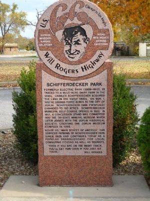
U.S. 66 - Will Rogers Highway
— Chicago to Los Angeles —
Formerly Electric Park (1909-1912), is traced to a multi-acre dairy farm in the 1890's. Charles Schifferdecker acquired the land in the early 1900s. On Nov. 1, 1913 he deeded forty acres to the city of Joplin. Schifferdecker Park eventually expanded to 160 acres. Schifferdecker Municipal Golf Course opened in 1922. In 1931, a concession stand was converted into the Tri-State Mineral Museum, which later joined with the Joplin Historical Society, creating the Joplin Museum Complex in 1996.
Route 66 "Main Street of America" has serviced patrons of Schifferdecker Park since 1926 and continues today as a popular thoroughfare for local commuting citizens as well as tourists.
"Even if you are on the right track, you'll get run over if you just sit there."
- Will Rogers
Topics and series. This historical marker is listed in these topic lists: Agriculture • Industry & Commerce • Roads & Vehicles. In addition, it is included in the U.S. Route 66 series list. A significant historical month for this entry is October 1861.
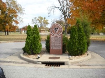
Location. 37° 5.106′ N, 94° 32.971′ W. Marker is in Joplin, Missouri, in Jasper County. Marker is at the intersection of Seventh Street and Schiffedecker Avenue, on the right when traveling west on Seventh Street. Touch for map. Marker is in this post office area: Joplin MO 64801, United States of America. Touch for directions.
Other nearby markers. At least 8 other markers are within 2 miles of this marker, measured as the crow flies. Schifferdecker Park & Joplin Museum Complex, Joplin, Missouri (approx. 0.2 miles away); Battle of Rader's Farm (approx. 0.2 miles away); Tri-State Mining Machinery (approx. 0.2 miles away); The Butterfly People (approx. 1.8 miles away); Survivor Quotes (approx. 1.8 miles away); Recovery Efforts: After the Storm (approx. 1.8 miles away); Tornado Statistics - May 22, 2011 - Joplin, MO (approx. 1.8 miles away); Butterfly Garden and Overlook (approx. 1.8 miles away). Touch for a list and map of all markers in Joplin.
More about this marker. Enter the Park on Schifferdecker Avenue. The marker cannot be accessed from Seventh Street as it is blocked by the Golf Course.
Regarding Schiffedecker Park. U.S. Route 66 was well-known as the Main Street of America, or the Mother Road, but not Will Rogers Highway. A congressional resolution to name Route 66 in honor of Will Rogers was considered in 1935 but was not finalized. In 1952, a number of bronze markers were placed to promote the Warner Brothers film "The Will Rogers Story". The U.S. 66 Highway Associaton, Ford Motor Company, and Warner Brothers took part in the promotion. A caravan drove along Route 66 from St. Louis to Santa Monica placing markers at each state line declaring the name Will Rogers Highway. It was only a movie promotion, not an actual re-naming of the highway.
Also see . . .
1. City of Joplin. The link for the City of Joplin. (Submitted on November 18, 2009, by Thomas Onions of Olathe, Kansas.)
2. Legends of America. Missouri Route 66 information from Legends of America. (Submitted on November 18, 2009, by Thomas Onions of Olathe, Kansas.)
3. Will Rogers. Wikipedia Entry for Will Rogers. (Submitted on November 18, 2009, by Thomas Onions of Olathe, Kansas.)
Additional keywords. Route 66
Credits. This page was last revised on August 11, 2023. It was originally submitted on November 18, 2009, by Thomas Onions of Olathe, Kansas. This page has been viewed 1,250 times since then and 33 times this year. Photos: 1, 2. submitted on November 18, 2009, by Thomas Onions of Olathe, Kansas. • Syd Whittle was the editor who published this page.

