Manassas, Virginia — The American South (Mid-Atlantic)
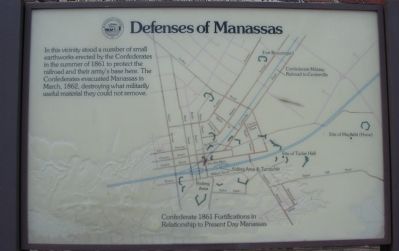
Defenses of Manassas
Erected by Manassas, Virginia.
Topics. This historical marker is listed in this topic list: War, US Civil. A significant historical month for this entry is March 1862.
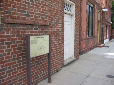
Location. 38° 45.053′ N, 77° 28.297′ W. Marker is in Manassas, Virginia. Marker is on Main Street, on the right when traveling south. Located in the block between Church and Center Streets. Touch for map. Marker is in this post office area: Manassas VA 20110, United States of America. Touch for directions.
Other nearby markers. At least 10 other markers are within walking distance of this marker. Our Story Continues (within shouting distance of this marker); Wartime Manassas (within shouting distance of this marker); Manassas 1906 (within shouting distance of this marker); Opera House (within shouting distance of this marker); 9366 Main Street (within shouting distance of this marker); The Right to Vote (about 300 feet away, measured in a direct line); Steam Locomotive Tire Fire Alarm – 1909 (about 300 feet away); Harry J. Parrish (about 300 feet away); a different marker also named Wartime Manassas (about 300 feet away); Site of Manassas Junction (about 400 feet away). Touch for a list and map of all markers in Manassas.
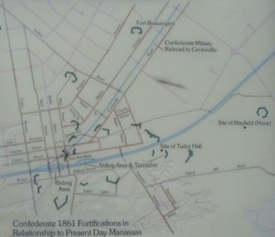
More about this marker. A map references “Confederate 1861 Fortifications in Relationship to Present Day Manassas.”
Also see . . .
1. Stereotype Photograph of Manassas Fort. This T.H. O'Sullivan photograph, formatted for use in stereo viewing devices popular in the late 1800s, shows Confederate earthwork fortifications standing next to the railroad. (Submitted on September 12, 2007, by Craig Swain of Leesburg, Virginia.)
2. Fortifications at Manassas Junction. Detailed analysis of some fortifications around Manassas based on photos and maps from the war. The subject photographs appear to be from those fortifications around the Tutor Hall Site. (Submitted on September 13, 2007, by Craig Swain of Leesburg, Virginia.)

Photographed By Craig Swain, September 2, 2007
3. Close Up View of the Map
Note the location of the present day train station near the siding area on the map. The Confederate Military Railroad runs between Mathis and Centreville Road (Route 28) in this area. The Fort Beauregard (with no remains existing) site is just South of the Manassas Shopping Center strip mall. The Mayfield fort (preserved in a park) is off to the east along Quarry Road. And several earthworks did stand in the vicinity of the Manassas Museum and the city park to the south of the railroad.
Credits. This page was last revised on June 16, 2016. It was originally submitted on September 12, 2007, by Craig Swain of Leesburg, Virginia. This page has been viewed 1,677 times since then and 22 times this year. Photos: 1, 2, 3. submitted on September 12, 2007, by Craig Swain of Leesburg, Virginia. • J. J. Prats was the editor who published this page.

