Katonah in Westchester County, New York — The American Northeast (Mid-Atlantic)
The Brick Lot
John Jay Homestead
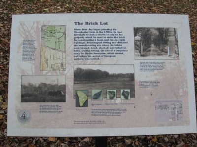
When John Jay began planning his Westchester farm in the 1790s, he was fortunate to find a source of clay on his property which he used to make the brick for constructing a home and various farm buildings. Archeological testing has identified the manufacturing site where the bricks were formed, dried, stacked, and baked in kilns. During testing, the site of a temporary camp for Native Americans, which existed well before the arrival of European settlers, was located.
Thousands of bricks, created in the southern end of this field between 1787 and 1801, were used to construct John Jay’s farm buildings and residence.
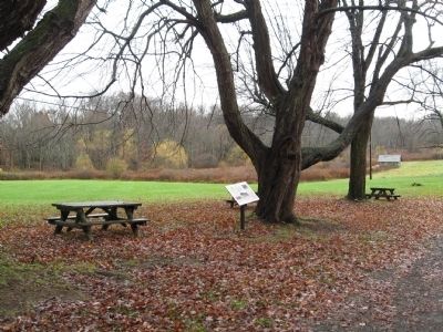
Erected by Friends of the Jay Homestead. (Marker Number 4.)
Topics. This historical marker is listed in these topic lists: Agriculture • Native Americans • Notable Places. A significant historical year for this entry is 1787.
Location. 41° 15.08′ N, 73° 39.521′ W. Marker is in Katonah, New York, in Westchester County. Marker can be reached from Jay Street (New York State Route 22) 0.1 miles south of Beaver Dam Road, on the left when traveling south. Located on the grounds of the John Jay Homestead. Touch for map. Marker is at or near this postal address: 400 Route 22, Katonah NY 10536, United States of America. Touch for directions.
Other nearby markers. At least 8 other markers are within walking distance of this marker. The Farm Manager’s Cottage (within shouting distance of this marker); Bedford House (within shouting distance of this marker); The John Jay Potting Sheds (within shouting distance of this marker); The Stable Courtyard (within shouting distance of this marker); The Barn Complex (about 300 feet away, measured in a direct line); John Jay Homestead (about 300 feet away); The Glasshouse Complex and Herb Garden (about 300 feet away); The Homestead Farm (about 300 feet away). Touch for a list and map of all markers in Katonah.
Photographed By Michael Herrick, November 10, 2009
3. Spruce Brook
[ detail from the marker ]
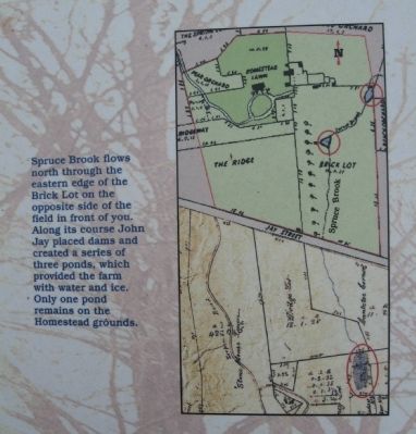
Spruce Brook flows north through the eastern edge of the Brick Lot on the opposite side of the field in front of you. Along its course John Jay placed dams and created a series of three ponds, which provided the farm with water and ice. Only one pond remains on the Homestead grounds.
Spruce Brook flows north through the eastern edge of the Brick Lot on the opposite side of the field in front of you. Along its course John Jay placed dams and created a series of three ponds, which provided the farm with water and ice. Only one pond remains on the Homestead grounds.
Photographed By Michael Herrick, November 10, 2009
4. The Farm Lane
[ detail from the marker ]
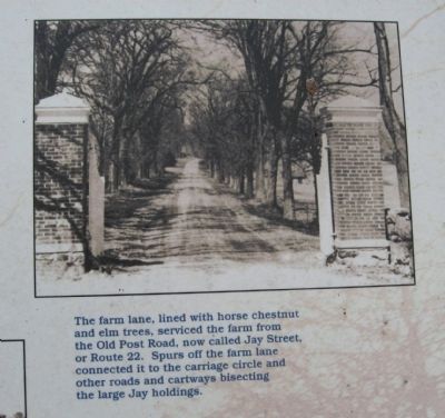
The farm lane, lined with horse chestnut and elm trees, serviced the farm from the Old Post Road, now called Jay Street, or Route 22. Spurs off the farm lane connected it to the carriage circle and other roads and cartways bisecting the large Jay holdings.
The farm lane, lined with horse chestnut and elm trees, serviced the farm from the Old Post Road, now called Jay Street, or Route 22. Spurs off the farm lane connected it to the carriage circle and other roads and cartways bisecting the large Jay holdings.
Photographed By Michael Herrick, November 10, 2009
6. Artifacts
[ detail from the marker ]
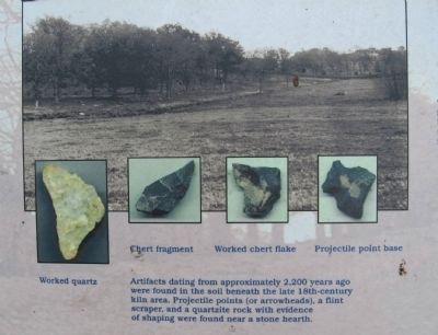
Artifacts dating from approximately 2,200 years ago were found in the soil beneath the late 18th century kiln area. Projectile points (or arrowheads), a flint scraper, and a quartzite rock with evidence of shaping were found near a stone hearth. Insets: chert fragment, worked chert flake, projectile point base.
Artifacts dating from approximately 2,200 years ago were found in the soil beneath the late 18th century kiln area. Projectile points (or arrowheads), a flint scraper, and a quartzite rock with evidence of shaping were found near a stone hearth. Insets: chert fragment, worked chert flake, projectile point base.
Credits. This page was last revised on June 16, 2016. It was originally submitted on November 21, 2009, by Michael Herrick of Southbury, Connecticut. This page has been viewed 888 times since then and 25 times this year. Photos: 1, 2, 3, 4, 5, 6. submitted on November 21, 2009, by Michael Herrick of Southbury, Connecticut. • Syd Whittle was the editor who published this page.
