Katonah in Westchester County, New York — The American Northeast (Mid-Atlantic)
The North Lawn
John Jay Homestead
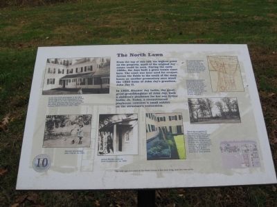
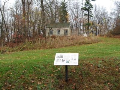
From the top of this hill, the highest point on the property, much of the original Jay estate could be seen. During the early 1900s, the jays built a grass tennis court here. The court was later used for croquet. Across the fields to the south of the main house on another promontory once stood the 1852 home of John Jay’s grandson, John Jay II.
In 1925, Eleanor Jay Iselin, the great-great-granddaughter of John Jay built a children’s playhouse for her son Arthur Iselin, Jr. Today, a reconstructed playhouse contains a small exhibit on the structure’s restoration.
There was no garden in the courtyard when the Jays and Iselins lived here. Today, the Hopp Ground Garden Club maintains a garden here for the benefit of those who are unable to enjoy the unpaved gardens located in other areas of the site. This garden includes plant materials from these other gardens.
Erected by Friends of the Jay Homestead. (Marker Number 10.)
Topics. This historical marker is listed in these topic lists: Agriculture • Notable Places. A significant historical year for this entry is 1852.
Location. 41° 15.101′ N, 73° 39.632′ W. Marker is in Katonah, New York, in Westchester County. Marker can be reached from Jay Street (New York State Route 22) 0.1 miles south of Beaver Dam Road, on the left when traveling south. Located on the grounds of the John Jay Homestead. Touch for map. Marker is at or near this postal address: 400 Route 22, Katonah NY 10536, United States of America. Touch for directions.
Other nearby markers. At least 8 other markers are within walking distance of this marker. The Terrace Garden (within shouting distance of this marker); The Carriage Drive and Roadways (within shouting distance of this marker); The Schoolhouse and Homestead Lawn (within shouting distance of this marker); Bedford House (about 300 feet away, measured in a direct line); The Beech Allee (Avenue) and Stone Fences (about 400 feet away); The Stable Courtyard (about 400 feet away); John Jay Homestead (about 500 feet away); The Brick Lot (about 500 feet away). Touch for a list and map of all markers in Katonah.
Photographed By Michael Herrick, November 10, 2009
3. The Main House
[ detail from the marker ]
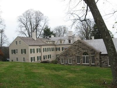
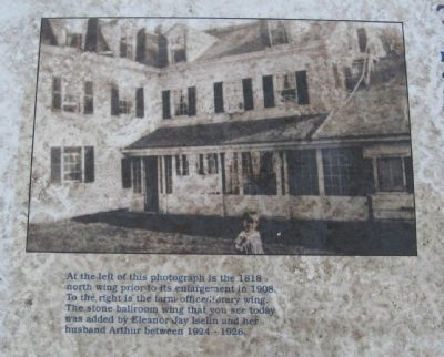
At the left of this photograph is the 1818 north wing prior to its enlargement in 1908. To the right is the farm office / library wing. The stone ballroom wing that you see today was added by Eleanor Jay Iselin and her husband Arthur between 1924 – 1926.
At the left of this photograph is the 1818 north wing prior to its enlargement in 1908. To the right is the farm office / library wing. The stone ballroom wing that you see today was added by Eleanor Jay Iselin and her husband Arthur between 1924 – 1926.
Photographed By Michael Herrick, November 10, 2009
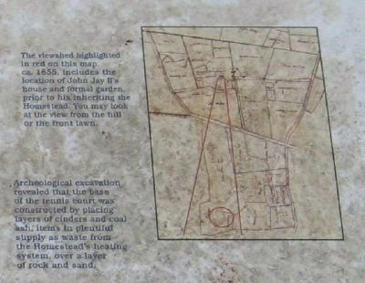
5. Homestead Map
[ detail from the marker ]
The views highlighted in red on this map, ca. 1855, includes the location of John Jay II’s house and formal garden prior to his inheriting the Homestead. You may look at the view from the hill or the front lawn.
Archeological excavation revealed that the base of the tennis court was constructed by placing layers of cinders and coal ash, item in plentiful supply as waste from the Homestead’s heating system, over a layer of rock and sand.
Credits. This page was last revised on June 16, 2016. It was originally submitted on November 21, 2009, by Michael Herrick of Southbury, Connecticut. This page has been viewed 711 times since then and 23 times this year. Photos: 1, 2, 3, 4, 5. submitted on November 21, 2009, by Michael Herrick of Southbury, Connecticut. • Syd Whittle was the editor who published this page.
