Blackshear in Pierce County, Georgia — The American South (South Atlantic)
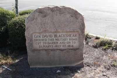
General Blackshear's Military Road
Ordered this military road
cut to Darien and on to
St. Marys July 1st. 1814
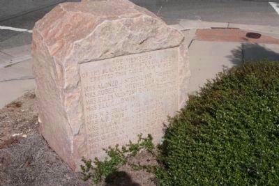
Erected 1925 by Blackshear Historical Society.
Topics. This historical marker is listed in these topic lists: Roads & Vehicles • War of 1812 • Wars, US Indian. A significant historical date for this entry is July 1, 1840.
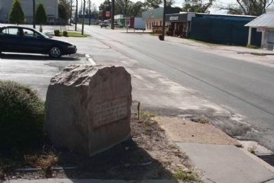
Location. 31° 18.281′ N, 82° 14.468′ W. Marker is in Blackshear, Georgia, in Pierce County. Marker is at the intersection of West Main Street (State Highway 15) and Highway Avenue, on the right when traveling west on West Main Street. Touch for map. Marker is in this post office area: Blackshear GA 31516, United States of America. Touch for directions.
Other nearby markers. At least 8 other markers are within 10 miles of this marker, measured as the crow flies. Pierce County (approx. 0.2 miles away); Confederate Prison Camp (approx. 0.9 miles away); Okefenokee Swamp (approx. 8.8 miles away); Nancy Hart Highway (approx. 9.1 miles away); Ware Court House (approx. 9.1 miles away); Senator Nicholas Ware (approx. 9.2 miles away); The Wildes Massacre (approx. 9.3 miles away); Methodism Came To Waycross (approx. 9˝ miles away). Touch for a list and map of all markers in Blackshear.
Regarding General Blackshear's Military Road. General David Blackshear built a chain of forts in the early 1800's along the Ocmulgee River for protection against the Indians during the War of 1812. This chain of 11 forts from Telfair County to Ft. Hawkins (present-day Macon, Ga.),One of these forts, Ft. Clark, probably named for Gen. Elijah Clark(e) and his son Gen. John Clark (later Governor of Ga.), was built at the present site of Blockhouse Church, Jacksonville, Ga., and was adjacent to a plantation owned by John Clark . General Blackshear is buried near the old community of Springfield, near Dublin, Ga.
Credits. This page was last revised on June 16, 2016. It was originally submitted on November 22, 2009, by Mike Stroud of Bluffton, South Carolina. This page has been viewed 2,007 times since then and 45 times this year. Photos: 1, 2, 3, 4. submitted on November 22, 2009, by Mike Stroud of Bluffton, South Carolina. • Craig Swain was the editor who published this page.


