Duleek in County Meath, Leinster, Ireland — Mid-East (and Dublin)
The Lime Tree
Duleek Heritage Trail
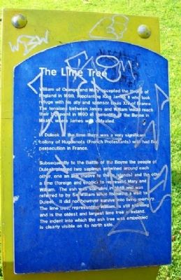
William of Orange and Mary accepted the throne of England in 1698, supplanting King James II who took refuge with his ally and sponsor Louis XIV of France. The tensions between James and William would reach their highpoint in 1690 at the battle of the Boyne in Meath, where James was defeated.
In Duleek at the time there was a very significant colony of Huguenots (French Protestants) who had fled persecution in France.
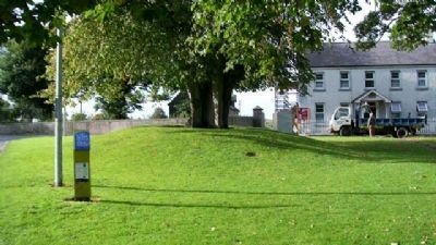
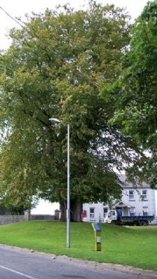
Subsequently to the Battle of the Boyne the people of Duleek planted two saplings entwined around each other, one an ash (native to the islands) and the other a lime (foreign and exotic) to represent Mary and William. The ash was still alive in 1849 and was referred to by Sir William Wilde following a visit to Duleek. It did not however survive into living memory. The lime tree, representing William, is still standing and is the oldest and largest lime tree in Ireland. The indent into which the ash tree was embedded is clearly visible on its north side.
Erected by Meath Tourism and EU Leader II Programme.
Topics and series. This historical marker is listed in these topic lists: Churches & Religion • Civil Rights • Patriots & Patriotism • Settlements & Settlers. In addition, it is included in the Historic Trees series list. A significant historical year for this entry is 1698.
Location. 53° 39.313′ N, 6° 24.999′ W. Marker is in Duleek, Leinster, in County Meath. Marker is on Main Street (Road 150), on the right when traveling north. Marker and lime tree are on the village green, the marker being about 30 feet NE of the old courthouse. Touch for map. Touch for directions.
Other nearby markers. At least 8 other markers are within 11 kilometers of this marker, measured as the crow flies. Duleek Courthouse (a few steps from this marker); Parochial House (within shouting distance of this marker); Connell's House (within shouting distance of this marker); St Mary's Abbey (about 120 meters away, measured in a direct line); Duleek 1916 - 1981 Hunger Strike Monument (approx. 0.7 kilometers away); The Woodhenge/Pit circle / The Winter Soltice (approx. 5.8 kilometers away); Knowth / Cnogbha (approx. 7.1 kilometers away); Saint Patrick on the Hill of Slane (approx. 10.8 kilometers away). Touch for a list and map of all markers in Duleek.
Credits. This page was last revised on January 2, 2020. It was originally submitted on November 25, 2009, by William Fischer, Jr. of Scranton, Pennsylvania. This page has been viewed 1,755 times since then and 48 times this year. Photos: 1, 2, 3, 4, 5. submitted on November 25, 2009.
