Red Wing in Goodhue County, Minnesota — The American Midwest (Upper Plains)
Barn Bluff
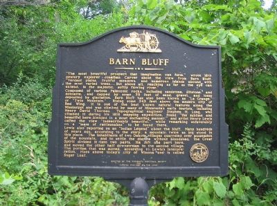
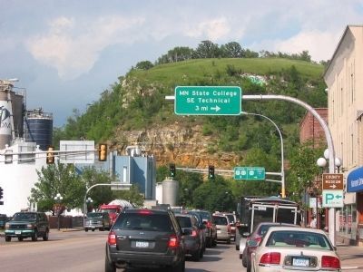
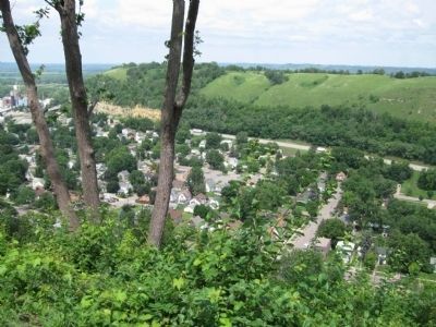
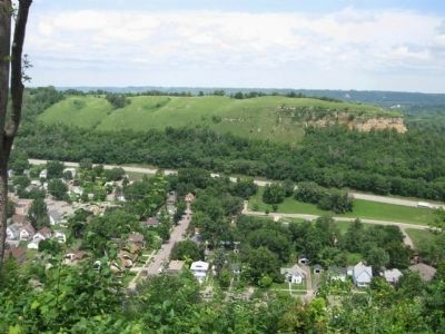
Composed of various Paleozoic rocks, including sandstone, siltstone, and dolomite, and capped by some 35 feet of sand, gravel, and loess deposited by glaciation, Barn Bluff has also been known as "LaGrange," or "Twin Mountain." Rising some 343 feet above the modern city of Red Wing, it is one of the best known natural features along the Mississippi and was climbed by many of Minnesota's early tourists, including Henry David Thoreau. Topographical engineer Stephen H. Long, who climbed it during his 1819 mapping expedition, found "the sublime and beautiful here blended in a most enchanting manner," and artist Henry Lewis called the view "incredibly beautiful" while remarking unfavorably on a "mass of rattlesnakes" to be found there.
Lewis also reported on an "Indian Legend" about the bluff. Many hundreds of years ago, according to the story, a mountain twice as big stood in this place. The inhabitants of two Dakota villages quarreled over possession of the mountain, and to settle the dispute without bloodshed, the Great Spirit divided it into two parts. He left one part here, and moved the other half downstream to the second village. The portion that was moved, according to Lewis's interpretation, rises above today's city of Winona and is called Sugar Loaf.
Erected 1989 by the Minnesota Historical Society; funding by the LCMR [Legislative Commission on Minnesota Resources].
Topics and series. This historical marker is listed in these topic lists: Landmarks • Native Americans • Natural Features. In addition, it is included in the Minnesota Historical Society series list. A significant historical year for this entry is 1819.
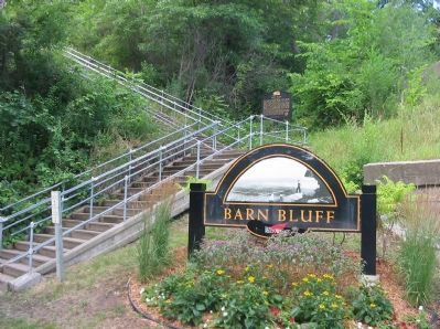
Location. 44° 34.086′ N, 92° 31.15′ W. Marker is in Red Wing, Minnesota, in Goodhue County. Marker can be reached from East 5th Street, half a mile east of Bluff Street, on the left when traveling east. Marker is southeast of the bluff, at the stairs going to the crest of the bluff. Touch for map. Marker is in this post office area: Red Wing MN 55066, United States of America. Touch for directions.
Other nearby markers. At least 8 other markers are within walking distance of this marker. Kiwanis Stairway (within shouting distance of this marker); The G.A. Carlson Lime Kiln (within shouting distance of this marker); Mt. La Grange – Barn Bluff (within shouting distance of this marker); Remember the Maine (approx. 0.3 miles away); Geology of Minnesota (approx. 0.4 miles away); a different marker also named Kiwanis Stairway (approx. 0.4 miles away); William Colvill (approx. 0.7 miles away); National Newspaper Association (approx. 0.8 miles away). Touch for a list and map of all markers in Red Wing.
More about this marker. The Legislative Commission on Minnesota Resources (LCMR), now the Legislative-Citizen Commission on Minnesota Resources (LCCMR), make funding recommendations to the legislature for special environment and natural resource projects.
Also see . . . Barn Bluff. Wikipedia entry. (Submitted on November 25, 2009.)
Credits. This page was last revised on June 7, 2021. It was originally submitted on November 25, 2009, by Keith L of Wisconsin Rapids, Wisconsin. This page has been viewed 1,639 times since then and 18 times this year. Photos: 1, 2, 3. submitted on November 25, 2009, by Keith L of Wisconsin Rapids, Wisconsin. 4, 5. submitted on August 9, 2011, by Keith L of Wisconsin Rapids, Wisconsin. • Craig Swain was the editor who published this page.
