Near Bakersfield in Kern County, California — The American West (Pacific Coastal)
Kern River Slough
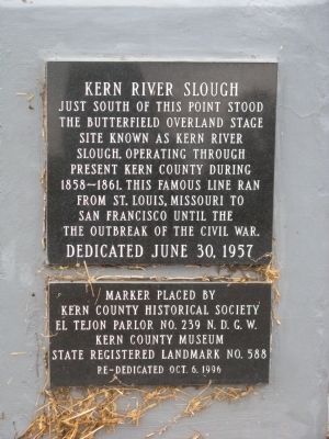
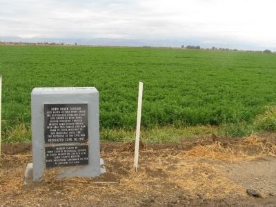
Just south of this point stood the Butterfield Overland Stage site known as Kern River Slough. Operating through present Kern County during 1858 – 1861. This famous line ran from St. Louis, Missouri to San Francisco until the outbreak of the Civil War.
Erected 1957 by Kern County Historical Society, El Tejon Parlor No. 239 N.D.G.W. and Kern County Museum. (Marker Number 588.)
Topics and series. This historical marker is listed in these topic lists: Industry & Commerce • Landmarks • Roads & Vehicles. In addition, it is included in the Butterfield Overland Mail, the California Historical Landmarks, and the Native Sons/Daughters of the Golden West series lists. A significant historical date for this entry is June 30, 1842.
Location. 35° 16.007′ N, 118° 58.13′ W. Marker is near Bakersfield, California, in Kern County. Marker is on Panama Road, 0.7 miles east of Cottonwood Road, on the right when traveling east. Touch for map. Marker is at or near this postal address: 3720 E Panama Rd, Bakersfield CA 93307, United States of America. Touch for directions.
Other nearby markers. At least 8 other markers are within 8 miles of this marker, measured as the crow flies. Pablo Galtes - Union Cemetery (approx. 6.8 miles away); Captain Elisha Stephens (approx. 6.9 miles away); Eternal Flame (approx. 6.9 miles away); Don José Jesús (J. J.) Lopez (approx. 7 miles away); The Global War On Terror (approx. 7½ miles away); Kern River Flour Mills (approx. 7.7 miles away); Site of Baker's Field (approx. 7.8 miles away); Kern County Hospital (approx. 7.8 miles away). Touch for a list and map of all markers in Bakersfield.
Regarding Kern River Slough. This site was designated California Historical Landmark No. 588 on May 22, 1957.
Also see . . .
1. History of the Butterfield Overland Stage. (Submitted on November 28, 2009, by Syd Whittle of Mesa, Arizona.)
2. John Butterfield and the Butterfield Overland Stage. (Submitted on November 28, 2009, by Syd Whittle of Mesa, Arizona.)
Credits. This page was last revised on February 18, 2022. It was originally submitted on November 28, 2009, by Syd Whittle of Mesa, Arizona. This page has been viewed 1,498 times since then and 38 times this year. Photos: 1, 2. submitted on November 28, 2009, by Syd Whittle of Mesa, Arizona.

