Brownsville in Fayette County, Pennsylvania — The American Northeast (Mid-Atlantic)
Brownsville
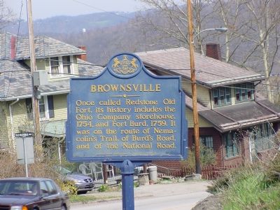
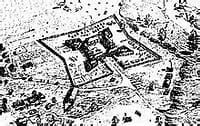
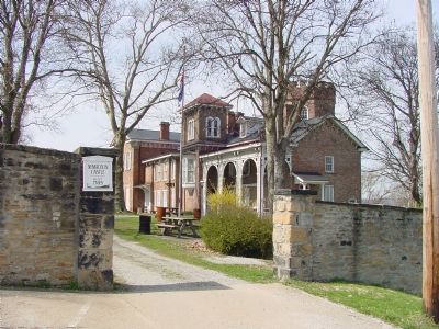
Once called Redstone Old Fort, its history includes the Ohio Company storehouse, 1854, and Fort Burd, 1759. It was on the route of Nemacolin's Trail, of Burd's Road, and of the National Road.
Erected 1946 by Pennsylvania Historical and Museum Commission. (Marker Number 17.)
Topics and series. This historical marker is listed in these topic lists: Industry & Commerce • Political Subdivisions • Roads & Vehicles • Settlements & Settlers. In addition, it is included in the Pennsylvania Historical and Museum Commission series list. A significant historical year for this entry is 1854.
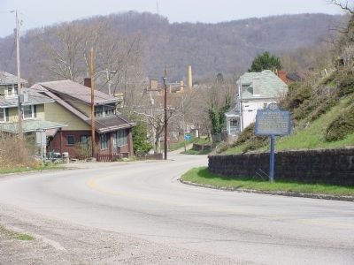
Location. 40° 1.101′ N, 79° 52.748′ W. Marker is in Brownsville, Pennsylvania, in Fayette County. Marker is on Broadway Street south of National Pike (U.S. 40), on the right when traveling east. Marker is at the curve where the roadway changes name from Broadway Street to Old National Road. Touch for map. Marker is in this post office area: Brownsville PA 15417, United States of America. Touch for directions.
Other nearby markers. At least 8 other markers are within walking distance of this marker. Brashear House (approx. ¼ mile away); Philander Knox (approx. ¼ mile away); Christ Episcopal Church (approx. 0.4 miles away); Bowman's Castle (approx. 0.4 miles away); Redstone Old Fort (approx. 0.4 miles away); Lafayette's Tour (approx. 0.4 miles away); Veterans Memorial (approx. half a mile away); Brownsville Military Honor Roll (approx. half a mile away). Touch for a list and map of all markers in Brownsville.
More about this marker. The original National Road turned onto Front Street on it's way through town to the Monongahela River.
Regarding Brownsville. Nemacolin's Trail ran from the mouth of Dunlap's Creek (Brownsville) to the Potomac River at Cumberland, Md. The National Road, and now Route 40, follow it.
Also see . . .
1. Brownsville, Pennsylvania. Wikipedia entry (Submitted on July 6, 2022, by Larry Gertner of New York, New York.)
2. Redstone Old Fort. Wikipedia entry (Submitted on July 6, 2022, by Larry Gertner of New York, New York.)
3. The National Road: Brownsville, PA. Gribble Nation website entry (Submitted on April 15, 2006.)
Photographed By J. J. Prats, April 11, 2006
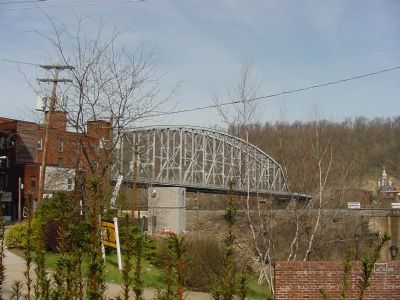
4. The Intercounty Bridge
Built early in the 20th Century, this bridge carried the National Road and then U.S. 40 until U.S. 40 was moved to a new bridge further east. It is still in use today spanning the sister Monongahela River towns of Brownsville and West Brownsville. It replaced a wooden covered bridge.
Photographed By J. J. Prats, April 11, 2006
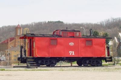
8. Monongahela Railway Caboose
Permanently parked next to Nemacolin Castle across Brashear Street, this caboose has the insignia of the Monongahela Railway, founded in Brownsville in 1900 and headquartered there. Mostly a coal carrier, it operated independently until 1993.
Credits. This page was last revised on July 8, 2022. It was originally submitted on April 15, 2006, by J. J. Prats of Powell, Ohio. This page has been viewed 2,444 times since then and 44 times this year. Last updated on July 6, 2022, by Bradley Owen of Morgantown, West Virginia. Photos: 1. submitted on April 15, 2006, by J. J. Prats of Powell, Ohio. 2. submitted on July 6, 2022, by Larry Gertner of New York, New York. 3, 4, 5, 6, 7. submitted on April 15, 2006, by J. J. Prats of Powell, Ohio. 8. submitted on April 18, 2006, by J. J. Prats of Powell, Ohio. • Bernard Fisher was the editor who published this page.
