Near Sharon in Taliaferro County, Georgia — The American South (South Atlantic)
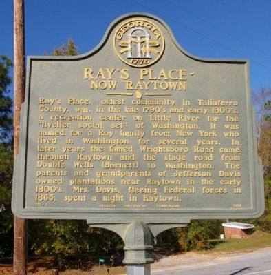
Ray's Place
Now Raytown
Erected 1956 by Georgia Historical Commission. (Marker Number 131-8.)
Topics and series. This historical marker is listed in these topic lists: Roads & Vehicles • Settlements & Settlers • War, US Civil. In addition, it is included in the Georgia Historical Society series list. A significant historical year for this entry is 1865.
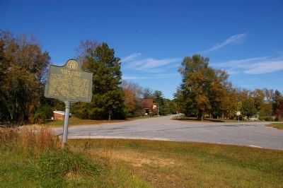
Location. 33° 34.16′ N, 82° 45.153′ W. Marker is near Sharon, Georgia, in Taliaferro County. Marker is at the intersection of Lumburg Sharon Road (County Route 79) and Double Wells Road (County Route 21), on the right when traveling east on Lumburg Sharon Road. Touch for map. Marker is in this post office area: Sharon GA 30664, United States of America. Touch for directions.
Other nearby markers. At least 8 other markers are within 8 miles of this marker, measured as the crow flies. Raytown Methodist Church (approx. 0.6 miles away); Robert Grier, Astronomer (approx. 0.7 miles away); Grave of Brig. Gen. Aaron W. Grier (approx. ¾ mile away); The Church of the Purification (approx. 2.4 miles away); South Liberty Presbyterian Church (approx. 2.6 miles away); Site of Chivers Plantation and Store (approx. 5.4 miles away); Birthplace of Alexander Hamilton Stephens (approx. 6.7 miles away); The Original R.F.D. (approx. 7.9 miles away). Touch for a list and map of all markers in Sharon.
Credits. This page was last revised on February 1, 2020. It was originally submitted on December 4, 2009, by David Seibert of Sandy Springs, Georgia. This page has been viewed 1,095 times since then and 34 times this year. Photos: 1. submitted on December 4, 2009, by David Seibert of Sandy Springs, Georgia. 2, 3. submitted on December 5, 2009, by David Seibert of Sandy Springs, Georgia. • Craig Swain was the editor who published this page.


