Intramuros in Manila, Metro Manila, Philippines — Southeast Asia
Ayuntamiento
Casa Consistoriales
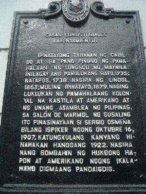
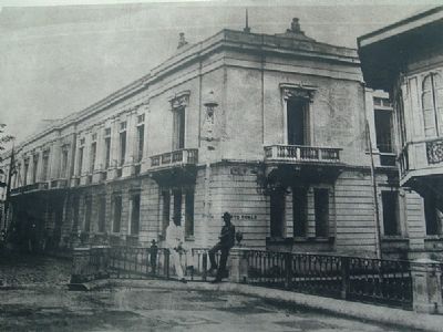
Ipinatayong tahanang ng Cabildo at iba pang pinuno ng pamahalaan ng Lungsod ng Maynila. Inilagay ang panulukang bato, 1735 natapos, 1738. Nasira ng lindol 1863; muling ipinatayo, 1879. Naging luklukan ng Pamahalaang kolonyal na Kastila at Amerikano at unang Asamblea ng Pilipinas. Sa Salón de Mármol ng gusaling ito pinasinayaan si Sergio Osmena bilang ispiker noong Oktubre 16, 1907, katungkulang kanyang hinawakaan hanggang 1922. Nasira nang bombahin ng hukbong Hapon at Amerikano noong ikalawang Digmaang pandaigdig.
Rough English Translation:
Built for the Cabildo and other government leaders of Manila. Cornerstone placed 1735, finished in 1738. Damaged by an earthquake in 1863; re-built, 1879. Government became the seat of colonial Spaniards, the Americans, and the first Assembly of the Philippines. In this building, the Salón de Mármol (Marble Hall), Sergio Osmena was inaugurated as speaker on October 16, 1907, he held office until 1922. Damaged during fighting between Japanese and American armies during World War II.
Topics. This historical marker is listed in this topic list: Notable Buildings. A significant historical month for this entry is October 1862.
Location. 14° 35.551′ N, 120° 58.404′ E. Marker is in Manila, Metro Manila. It is in Intramuros. Marker is on Cabildo Street, on the right when traveling north. Touch for map. Marker is in this post office area: Manila, Metro Manila 1002, Philippines. Touch for directions.
Other nearby markers. At least 8 other markers are within walking distance of this marker. Plaza de Roma (within shouting distance of this marker); Padre Jose A. Burgos (within shouting distance of this marker); Manila Cathedral (about 90 meters away, measured in a direct line); Plaza Santo Tomas (about 120 meters away); Colegio de Santa Rosa (about 120 meters away); Former Palace of the Governors General (about 120 meters away); University of Santo Tomas (about 120 meters away); Plaza de España (about 180 meters away). Touch for a list and map of all markers in Manila.
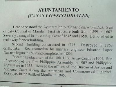
Regarding Ayuntamiento. Another marker on this site (see picture left) provides additional information about the Ayuntamiento. It reads:
Here once stood the Ayuntamineto (Casa Consistoriales). Seat of City Council of Manila. First structure built from 1599 to 1607. Severely damaged in the earthquake of 1645 and 1658. Demolished to make way for a new building.
Second building constructed in 1735. Destroyed in 1863 earthquake. Reconstruction by military engineer Eduardo Lopez Navarro begun in 1879 and completed in 1884.
Became headquarters of the 8th U.S. Army Corps in 1901. Site of sessions of the First Philippine Assembly in 1907 and Philippine Legislature in 1935. Housed the offices of the Bureau of Justice and Supreme Court during American and Commonwealth period. Destroyed in the Battle of Manila in 1945.
Credits. This page was last revised on February 12, 2022. It was originally submitted on December 5, 2009, by I.G.V.Atajar of San Jose, California. This page has been viewed 2,278 times since then and 79 times this year. Photos: 1, 2. submitted on December 5, 2009, by I.G.V.Atajar of San Jose, California. 3. submitted on December 8, 2009, by I.G.V.Atajar of San Jose, California. 4. submitted on December 5, 2009, by I.G.V.Atajar of San Jose, California. • Kevin W. was the editor who published this page.


