Marker Logo HMdb.org THE HISTORICAL
MARKER DATABASE
“Bite-Size Bits of Local, National, and Global History”
Roland Park in Baltimore, Maryland — The American Northeast (Mid-Atlantic)
 

Roland Park

National Register of Historic Places


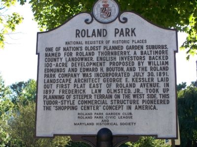
Roland Park Marker image. Click for full size.
Photographed By William Pfingsten, September 16, 2007
1. Roland Park Marker
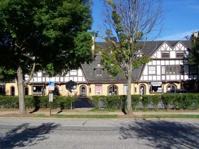
Inscription. One of nation’s oldest planned garden suburbs. Named for Roland Thornberry, a Baltimore County landowner. English investors backed 100-acre development proposed by William Edmunds and Edward H. Boulton, and the Roland Park Company was incorporated July 30, 1891. Landscape architect George E. Kessler laid out first plat east of Roland Avenue in 1897. Frederick Law Olmstead, Jr., took up planning of steeper terrain on the west side. This tudor-sytle commercial sturcture pioneered the “shopping center” concept in America.
 
Erected by Roland Park Garden Club, Roland Park Civic League and Maryland Historical Society.
 
Topics. This historical marker is listed in these topic lists: Industry & CommerceSettlements & Settlers. A significant historical date for this entry is July 30, 1849.
 
Location. 39° 21.016′ N, 76° 38.123′ W. Marker is in Baltimore, Maryland. It is in Roland Park. Marker is at the intersection of Roland Park Avenue and Upland Road, on the left when traveling north on Roland Park Avenue. Touch for map. Marker is in this post office area: Baltimore MD 21210, United States of America. Touch for directions.
 
Other nearby markers. At least 10 other markers are within walking distance of this marker. Bolton Street Synagogue Stone Run Path Restoration (approx. 0.6 miles away); St. Theresa of Avila (approx. 0.6 miles away); St. Robert Bellarmine (approx. 0.6
Paid Advertisement
Click on the ad for more information.
Please report objectionable advertising to the Editor.
Click or scan to see
this page online
miles away); Dorothy Day (approx. 0.6 miles away); Mary Elizabeth Lange (approx. 0.7 miles away); St. Robert Southwell (approx. 0.7 miles away); St. Elizabeth Ann Seton (approx. ¾ mile away); The Mount St. Agnes College Cross (approx. 0.8 miles away); World War II Memorial (approx. 0.8 miles away); St. Ignatius Loyola (approx. 0.9 miles away). Touch for a list and map of all markers in Baltimore.
 
First Shopping Center image. Click for full size.
Photographed By William Pfingsten, September 16, 2007
2. First Shopping Center
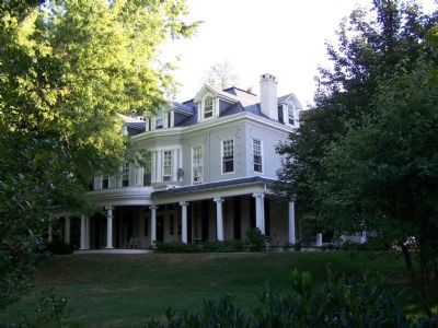
Example of a typical Roland Park home image. Click for full size.
Photographed By William Pfingsten, September 9, 2007
3. Example of a typical Roland Park home
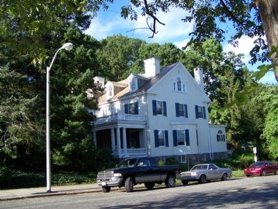
Another Roland Park home. image. Click for full size.
Photographed By William Pfingsten, September 16, 2007
4. Another Roland Park home.
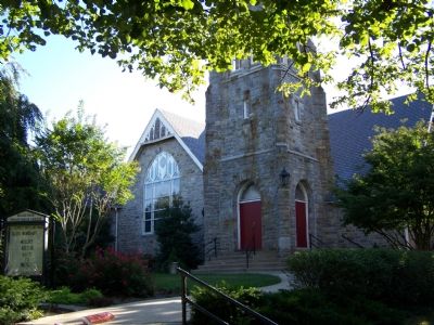
Roland Park Presbyterian Church across from the marker. image. Click for full size.
Photographed By William Pfingsten, September 16, 2007
5. Roland Park Presbyterian Church across from the marker.
 
 
Credits. This page was last revised on August 6, 2021. It was originally submitted on September 16, 2007, by Bill Pfingsten of Bel Air, Maryland. This page has been viewed 4,939 times since then and 86 times this year. It was the Marker of the Week October 7, 2007. Photos:   1, 2, 3, 4, 5. submitted on September 16, 2007, by Bill Pfingsten of Bel Air, Maryland. • J. J. Prats was the editor who published this page.
Share this page.  
Share on Tumblr
m=2524

CeraNet Cloud Computing sponsors the Historical Marker Database.
This website earns income from purchases you make after using our links to Amazon.com. We appreciate your support.
Paid Advertisement
Apr. 25, 2024